
INLAND IMPACTS EXPECTED FROM FLORENCE
Florence is lingering just off the southeastern NC coast late this afternoon as a Category 2 hurricane with maximum sustained winds of 105 mph. This hurricane, although weakened, is still a very big threat to life and property. The winds are SUSTAINED at 105 which means the winds do not let up. Gusts will be higher, perhaps up to 120 mph. Structural damage to buildings as well as storm surge flooding is already taking place. Florence is expected to drift slowly westward before making landfall somewhere near Wilmington, although it MAY not be directly AT Wilmington. Then she will drift along the NC/SC border bringing extremely heavy flooding rains.
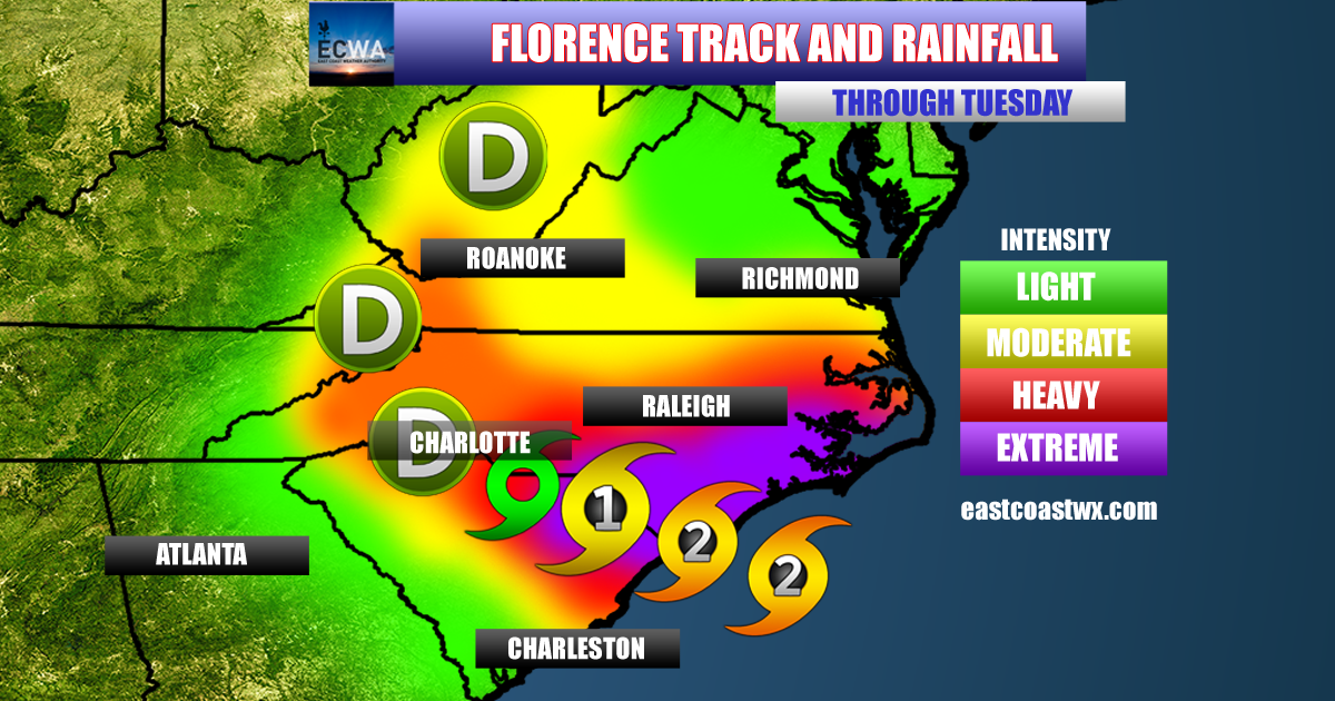
She will continue to weaken as she continues west, and will drift near Charlotte in the next few days. She could be a minimal tropical storm by the time she reaches Charlotte, but will continue to weaken. The biggest threat however, will be the flooding rains. Turn around, don’t drown.
-Mike Griffith
Meteorologist
You must be logged in to post a comment.