
Hurricane Florence continues to barrel towards the NC coastline as a catastrophic Category 4 hurricane with sustained winds of 120 mph. This is a large and extremely dangerous hurricane.
Latest official NHC track takes the storm into SE NC near Wilmington, or Wrightsville Beach, NC. Areas to the northeast of landfall are Moorehead City and Jacksonville, NC.
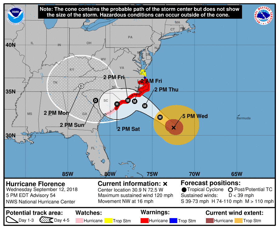
Catastrophic impacts will be felt all the way from these locations to Greenville, NC where flooding, wind damage, and extended power outages are all very likely. The northeast quadrant of the storm is the most dangerous with tornadoes and extreme winds and storm surge. The surge is the number one killer in hurricanes by far.
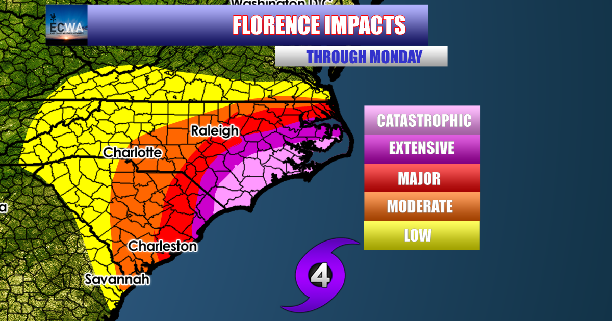
The hurricane could ride the coast to the SW making for catastrophic impacts to the west of Wilmington and down to the NC/SC border. The storm is then expected to meander inland along the SC/NC state line, still bringing extreme impacts in the way of high winds and flooding, also extended power outages.
Residents should have already evacuated by now if told to do so. As this hurricane approaches, conditions will deteriorate rapidly and it may be too late to get out. Please heed ALL orders by local authorities and consult your local NWS office for official info. Also check the NHC for official forecasts.
This hurricane WILL strike land and poses a DIRECT threat to life and property. Heed ALL warnings and GET OUT NOW!
-Mike Griffith
Meteorologist
You must be logged in to post a comment.