
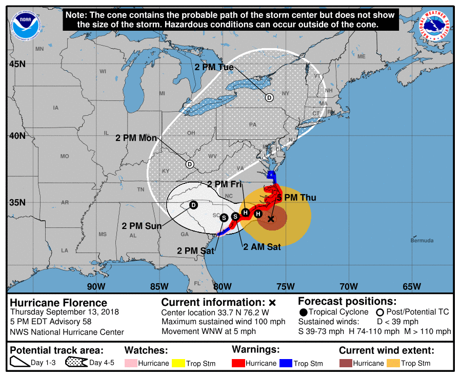
Hurricane Florence is an enormous Category 2 storm with sustained winds of 105 mph with gusts up to 120-130 mph. She is moving just off the coast of the Carolinas west-northwest at 5 mph and is already wreaking havoc. Florence is expected to make landfall early Friday morning near Wilmington, North Carolina and continue her journey westward. A Hurricane warning is in affect from Myrtle Beach to the North Carolina/Virginia Beach border. Parts of Southeast Virginia are under a tropical storm warning.
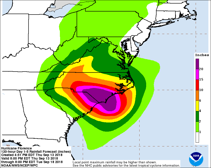
A storm surge warning is in affect for portions of the Carolinas. Northern South Carolina and most of North Carolina are in life-threatening danger of torrential rainfall and storm surges. Expect to see 15-20 inches of rainfall. According to the NHC, heavy rainfall combined with ocean water crashing onshore is the “deadliest most destructive ingredient” in a hurricane. Outer rain bands are expected to lash parts of Georgia and southern Virginia.
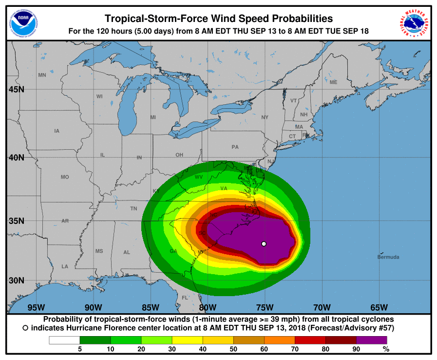
Do not take these watches/warnings lightly, and if you are told to evacuate, do it!!! The leading cause of deaths in hurricanes is the flooding itself. Storm surges, torrential rainfall, power outages, and tropical storm winds will make a huge impact on the East Coast. Although the Carolinas will get the brunt of the hurricane, we will still be able to feel her wrath along the east coast. Please be safe out there and listen to local authorities.
You must be logged in to post a comment.