
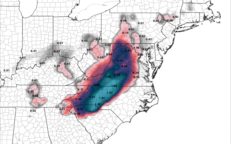
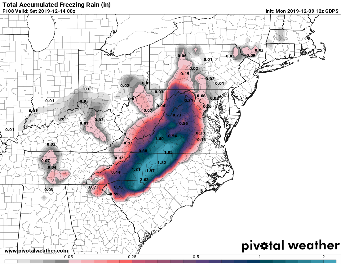
The Canadian model could be off its rocker, with a crippling ice storm for the western Carolinas and Virginia. This can be worrisome because ice storms are the hardest weather event to predict, at least for us. Could this model below actually verify? We don’t think so. We think the event will still be limited to north and west of Charlotte and will be a light glaze, and change to all rain and melt by lunchtime. Extreme caution is still advised for travel, or maybe not depending on how bad it gets.
However, ice storms are extremely difficult to predict even 24 hours in advance and the ice could be much worse than first thought. Keep your head on a swivel early Friday morning, and be certain to check your local news media outlet for the latest conditions before venturing out. Again, the below ice amounts are not to be taken exact, we are just communicating uncertainty.
You must be logged in to post a comment.