
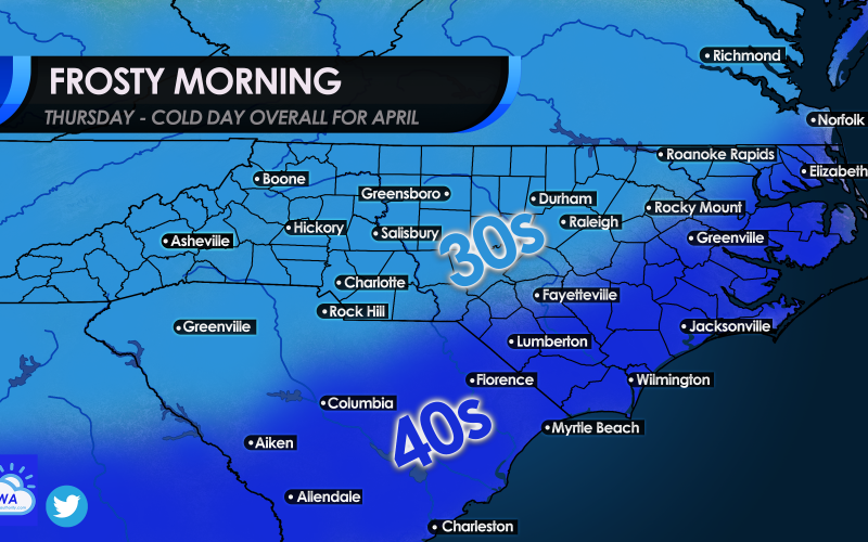
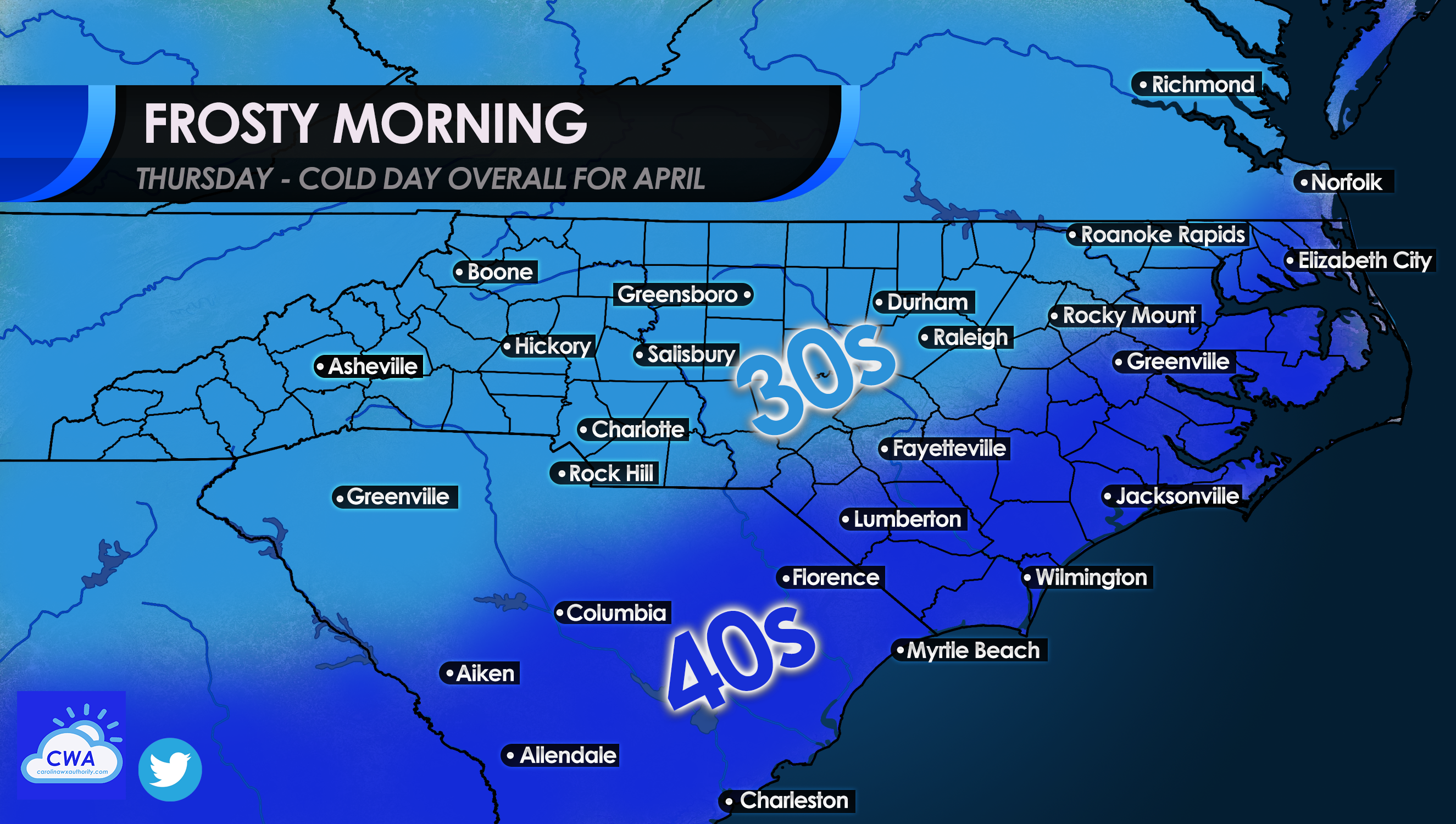
Wednesday will bring big changes in the way of a powerful cold front moving though. Then Wednesday night conditions will turn cold and blustery, and by Thursday morning many could see lows in the 30s. But mainly in the upper 30s. Coastal locations could see no higher than the 40s for lows.
The Northeast will be receiving snow along with this same cold event, far northern locations such as upstate NY and into New England. There could be a swath of snow from the Midwest to the Northeast with this next system.
Therefore the Southeast will be some of the recipients of cold air behind this storm system. The threat of frost will be across the lighter blue areas. A freeze is not expected at this time. However patchy frost cannot be ruled out.
Make sure to bring pets inside and protect any outdoor plants if you live in the 30s or close zone. The chill is expected to last for a bit! Below normal temperatures may persist beyond Thursday!
You must be logged in to post a comment.