
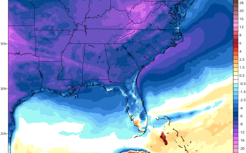
As we start out the work week, the threat for showers will increase across the Carolinas. This is due to some moisture flow up from the Gulf. Then on Tuesday we will be sunny, as it will be the best day this week. On Wednesday a powerful cold front moves through, and it will be cold and windy into Wednesday night. By Thursday morning, it could feel frosty with morning lows in the 40s. Below is the forecast departure from normal for Thursday during the day.

So, spotty sprinkles on Monday, cloudy, then clearing out for Tuesday. Then our next feature arrives from our west on Wednesday as a cold front, and will send us more below average temperatures for Thursday and the rest of the week.
You must be logged in to post a comment.