
Trouble is brewing in the Gulf, and Florida needs to be on alert over the next 5 days or so. The waters are hot, and this acts as fuel for hurricanes to intensify.
From our very own StormTracker Jesse Sacher:
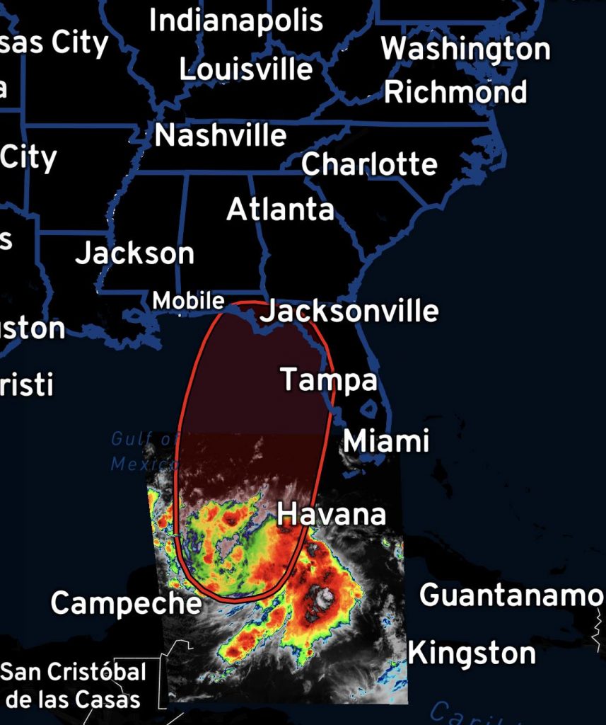
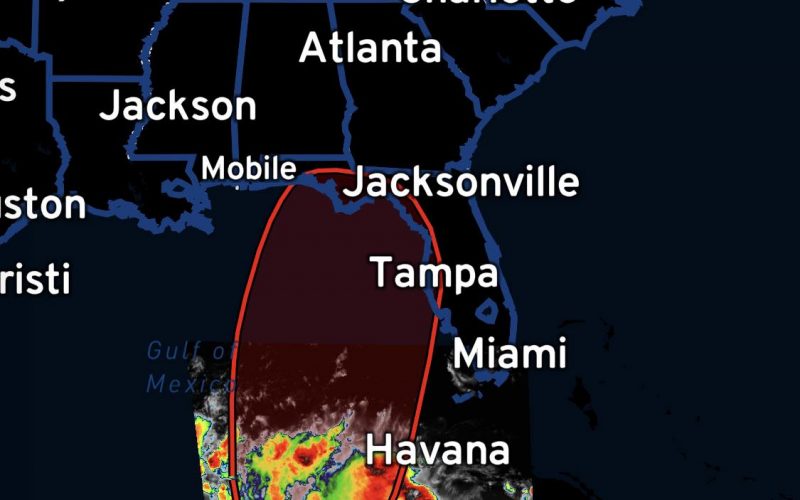
TALKING TROPICS: Invest 93L, currently over Yucatán, soon likely to become Tropical Depression Idalia as the National Hurricane Center has placed a 90% probability of cyclonic development over the Gulf of Mexico. The concern here is that Idalia may strengthen rapidly in the Gulf due to a large area of very warm ocean temperatures and could plausibly reach impactful hurricane status before making a landfall somewhere over the eastern Gulf Coast sometime around the middle of this upcoming week. Florida Governor Ron Desantis has already issued a state of emergency for Florida residents. Much of Florida, particularly the peninsula, and Georgia/Carolina coasts should monitor upcoming forecasts in the days ahead.![]()
The Lowcountry should monitor this system for tropical storm impacts Tuesday-Wednesday next week. This includes Charleston, Hilton Head, Beaufort, and Savannah.
Official information as of Saturday evening:
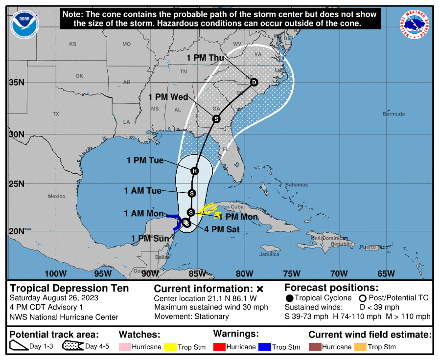
Tropical Depression Ten Discussion Number 1 NWS National Hurricane Center Miami FL AL102023 400 PM CDT Sat Aug 26 2023
The cloud pattern of the low pressure area located near the northeastern Yucatan Peninsula of Mexico has gradually become better organized today. Radar observations show a circulation has developed, although surface observations indicate that the western semicircle of this circulation is rather weak at this time. Given the increased organization, advisories are being initiated on Tropical Depression Ten. Surface synoptic observations suggest that the current intensity is around 25 kt. The current motion estimate is nearly stationary. There is a weakness in the subtropical ridge to the north of the tropical cyclone, leaving the system in a region of very weak steering flow. The dynamical guidance indicates that the system will remain in weak steering currents for the next 24 to 36 hours, so very little motion is predicted during that period. After that time, a mid-level ridge begins to build to the east of the tropical cyclone. This should cause a generally northward motion in the next 2 to 3 days. Then, a gradual turn to the north-northeast is expected as the system moves along the northwestern periphery of the ridge. The official track forecast is a blend of the simple and corrected dynamical model consensus guidance. The tropical cyclone will be moving over very warm waters with only moderate vertical wind shear anticipated during the next several days. Therefore, gradual strengthening is forecast. The official forecast is similar to the latest LGEM guidance and shows the system becoming a hurricane over the eastern Gulf of Mexico. Users are reminded that there is significant uncertainty in 3-4 day intensity predictions and are urged to monitor changes to future forecasts. KEY MESSAGES: 1. Heavy rainfall from Tropical Depression Ten is expected across the eastern Yucatan Peninsula and western Cuba. The heavy rainfall may produce areas of flash and urban flooding, as well as landslides, across western Cuba. The depression is forecast to become a tropical storm by Sunday, and tropical storm conditions are expected over portions of the Yucatan Peninsula where a Tropical Storm Warning is in effect. Tropical storm conditions are possible over portions of western Cuba within the Tropical Storm Watch area. 2. The depression is forecast to strengthen during the next few days and could become a hurricane over the eastern Gulf of Mexico, bringing a potential of dangerous storm surge, heavy rainfall, and strong winds to portions of the west coast of Florida and the Florida Panhandle by the middle of next week. Heavy rainfall is also likely to spread into portions of the Southeast U.S. by mid to late next week. Although it is too soon to specify the exact location and magnitude of these impacts, residents in these areas should monitor updates to the forecast of this system and ensure that they have their hurricane plan in place.
Stay with us here at Carolina Weather Authority so we can get you through this storm!
You must be logged in to post a comment.