
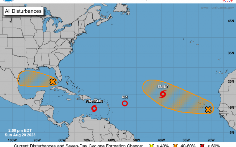
Hey there, and happy Sunday evening! We have some items to talk about in the tropics, and the latest NHC outlook graphic is lighting up like a Christmas tree.
We already have Emily and Franklin! And also Tropical Depression 6. Below is what the Euro model COULD look like before the end of the month, around the last week of August. It looks like anything that forms in the Caribbean will go out to sea, but might hook left or go more due north to impact parts of Atlantic Canada. But what we have to watch is a storm potentially impacting Florida.
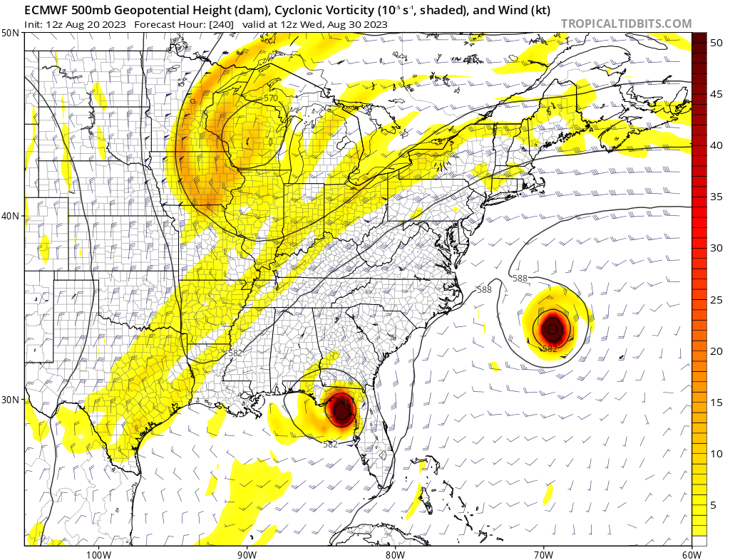
For now, we are definitely thinking more of an impact for the Florida storm, but it’s still too early to tell with deterministic model runs. The entire west coast of Florida should monitor the tropics for the remainder of the month.
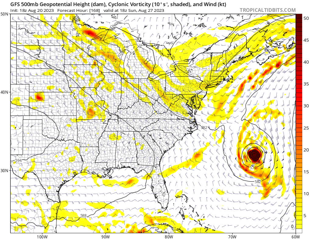
The GFS doesn’t show to Florida storm, but agrees with the Euro that something could be looming off the East Coast later this week.
Impacts are not expected for the Carolinas other than rip currents. As of now, and through the end of the month, we are not expecting any tropical systems! So that’s really good news.
Keep following us on FB and make sure you click on all our latest articles!
You must be logged in to post a comment.