
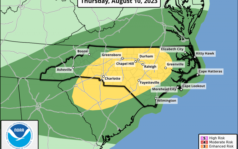
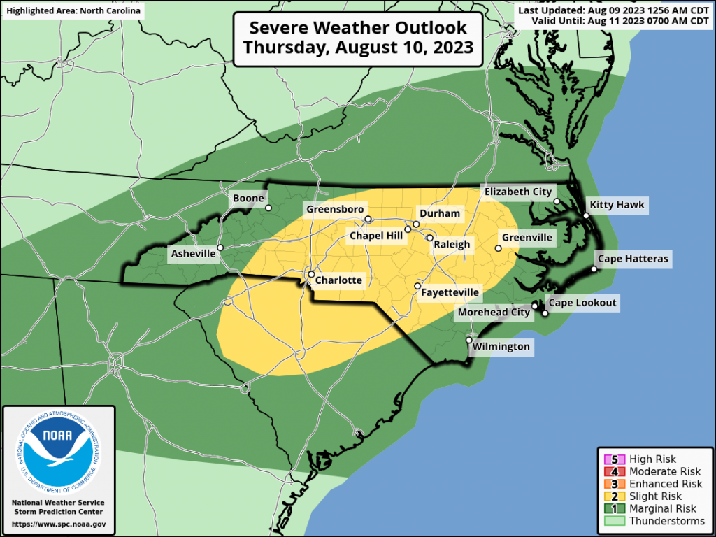
As a system of low pressure moves in from our west on Thursday, showers and storms will result with some being severe. The yellow outline below is where the highest chance of severe storms will be.
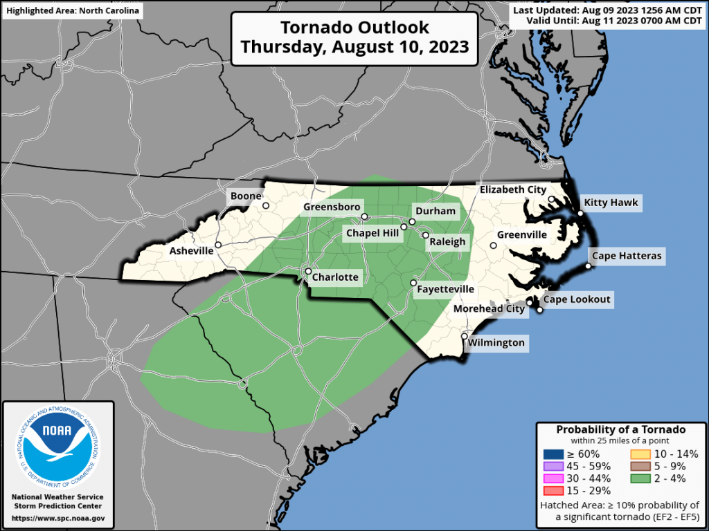
What are the biggest threats with tomorrow’s storms? There is a low threat of a tornado (below) but not zero, so any storm could produce a tornado warning.
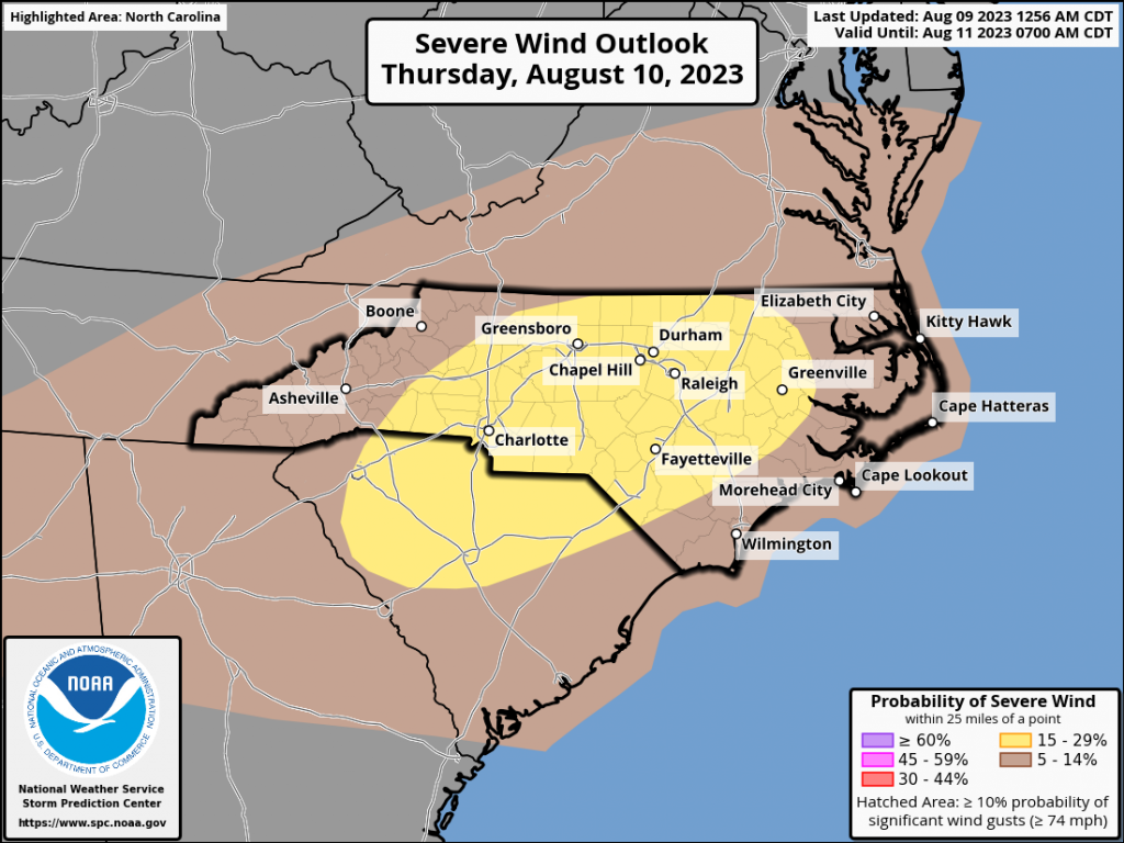
However, the biggest threat is damaging winds (below), in excess of 58 mph which could take down trees and power lines.
What is the timing of the storms? Early Thursday morning so be ready! Expect bad travel conditions anywhere in the yellow. Official SPC discussion:
 ..TN Valley into the Carolinas/Mid-Atlantic...
   Showers and thunderstorms will likely be ongoing from the
   middle/upper OH Valley southwestward through the TN Valley early
   Thursday morning, ahead of shortwave trough moving through the OH
   and TN Valleys. This broad area of showers and thunderstorms is
   expected to gradually shift eastward as the shortwave trough
   continues eastward throughout the day. These showers and
   thunderstorm should limit destabilization across the Upper OH Valley
   and northern Mid-Atlantic, but some potential for destabilization
   exists farther south from eastern TN and northern AL/GA into the
   Carolinas and southern VA. Thunderstorm development would be likely
   in this area as the approaching cold front interacts with the
   destabilized air mass. Strong mid-level flow supports the potential
   for organized storms, with a bowing/line segment mode most likely.

   One caveat regarding that scenario is the potential for early period
   showers and thunderstorms to linger and limit destabilization.
   Additionally, there is also some potential for the early storms to
   be strong enough to overturn the airmass. Despite these
   uncertainties, strong deep-layer shear suggests any robust
   convection could be severe, and 15% wind probabilities were
   introduced across the central and eastern Carolinas where highest
   confidence in storms exists. Less buoyancy is anticipated with
   northern extent into VA, but strong wind fields merit a northward
   expansion of the 5% wind probabilities.
You must be logged in to post a comment.