
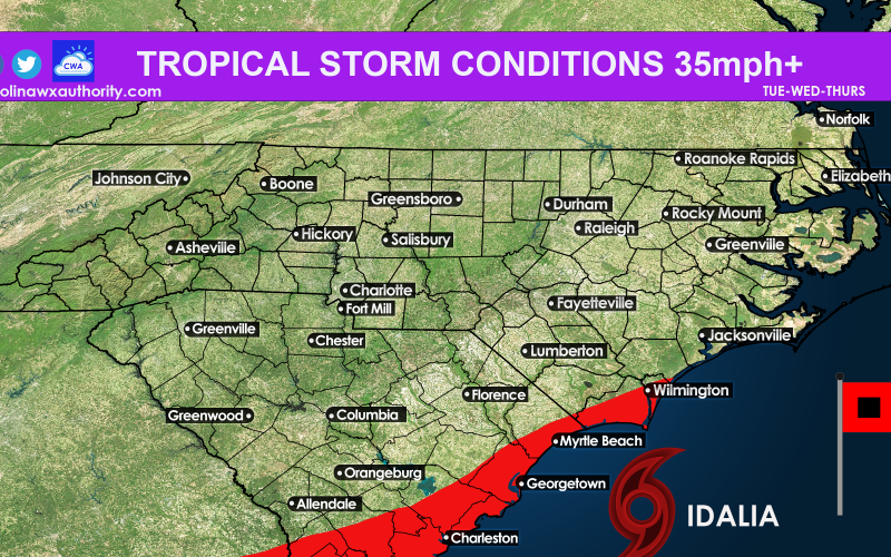
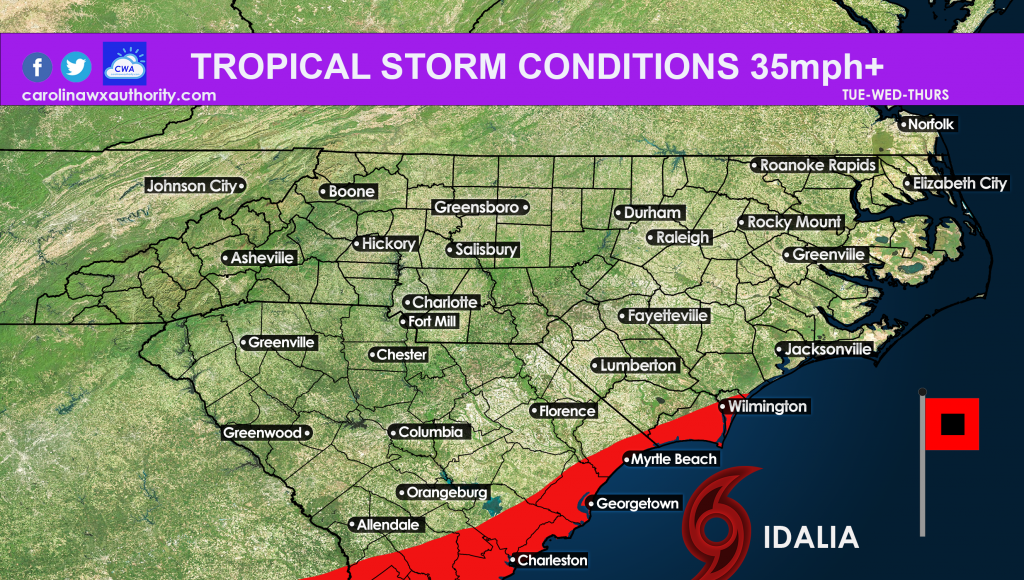
We’ve been posting about the Lowcountry seeing a tropical storm this week, and it looks like it will come to fruition. First, we have to watch Florida and see how strong Idalia is when she makes landfall. The strong she is at landfall, the more we should be concerned along the coast for a strong storm.
As for now, we are expecting tropical storm force winds and rains in the Lowcountry. These condtions could also clip extreme SE NC.
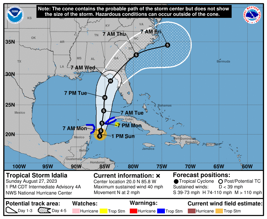
The official cone of uncertainty from the NHC is below. Note the S symbol which means tropical storm. Expected timings of the location of the storm are in the graphic. The track may wobble some within this cone either to the west or east. But confidence is steady as of now and has not changed much.
Residents can expect power outages and coastal flooding, especially in Charleston with the King Tide and full moon. Areas prone to flooding normally will be even more prone during this storm. Seek higher ground if you are in any flood areas including downtown.
Always consult your local NWS office for all tropical storm and hurricane safety information, and should be used as the official source for protecting life and property.
Stay with us here at CWA as this situation unfolds!
You must be logged in to post a comment.