

Idalia is expected to strengthen in the Gulf of Mexico further, and will become a category 2 and eventually a major hurricane which is described as a category 3 or higher. Florida will feel the most extreme impacts of anyone. But then it will make its way up here later this week.

We’re looking at Wednesday as the earliest arrival of tropical storm conditions for Charleston and the Lowcountry. Then conditions deteriorate into Thursday. Wilmington and SE NC also watch for moderate impacts including flooding, coastal flooding, and tropical storm force winds.
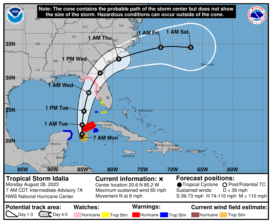
When Idalia gets to Charleston, Beaufort, she could be a 60mph tropical storm. So this is actually a stronger tropical storm with more impacts than a weak one. Savannah could see a hurricane out of this, as a category 1.
We might be fortunate enough for her to turn sooner out to sea, or if the eye remains offshore. That is possible. But in the meantime she will be a large storm, so outer rain bands can bring stormy and windy conditions inland.
Follow your local NWS for all weather-related safety information including property and life.
You must be logged in to post a comment.