
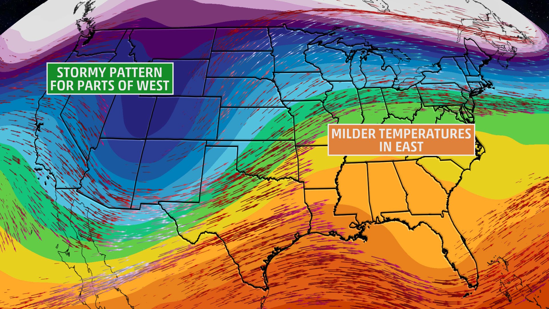
We all know by now that the pattern for the upcoming week or so is not going to favor extreme cold or winter storms. There will, however, be cold air damming across the Carolinas, with some places not getting out of the 30s for highs this week. A cold rain will combine with the cooler temperatures to create raw, damp conditions. Meanwhile, out west will start to experience a more active pattern, including mountains snows and rain elsewhere, causing flash floods and mudslides.
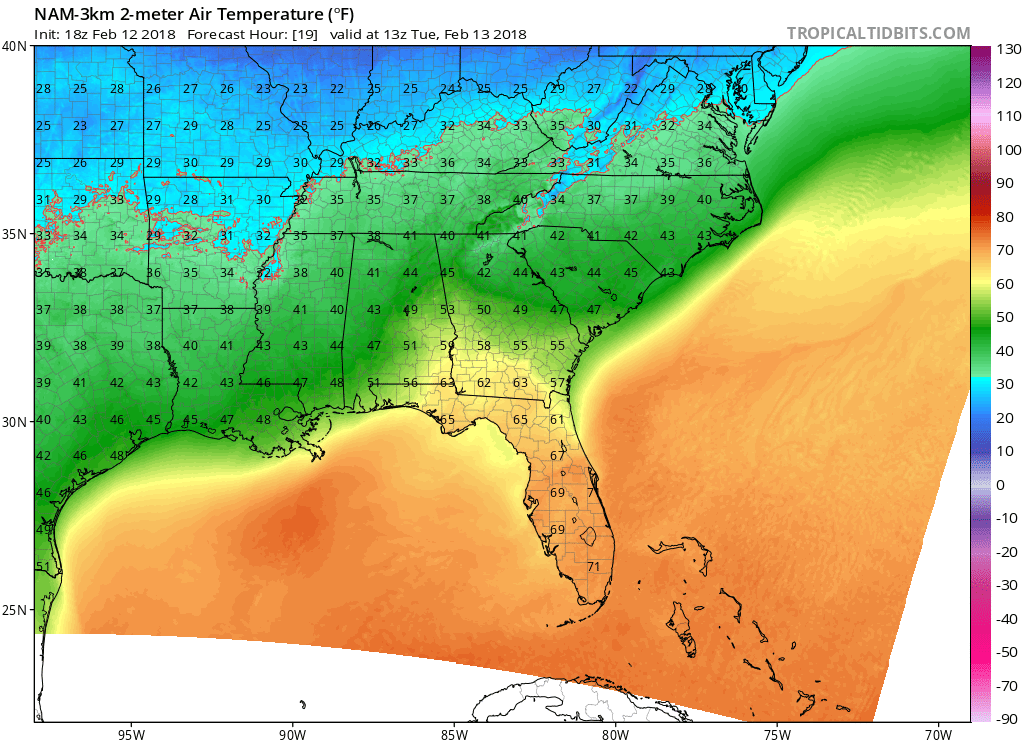
Back here in the Carolinas, it will be chilly. Just how chilly? Temperatures across the region will struggle to get out of the 40s for both NC and SC. Down in GA, 50s will be the general high temperatures.
This does not mean snow. This just means that it is going to be slightly cooler than first expected. Cold air damming events will mitigate any kind of extreme warm up. This is not uncommon for this time of year. The overall pattern still does not favor cold and snow across the Southeast.
-Mike G.
You must be logged in to post a comment.