
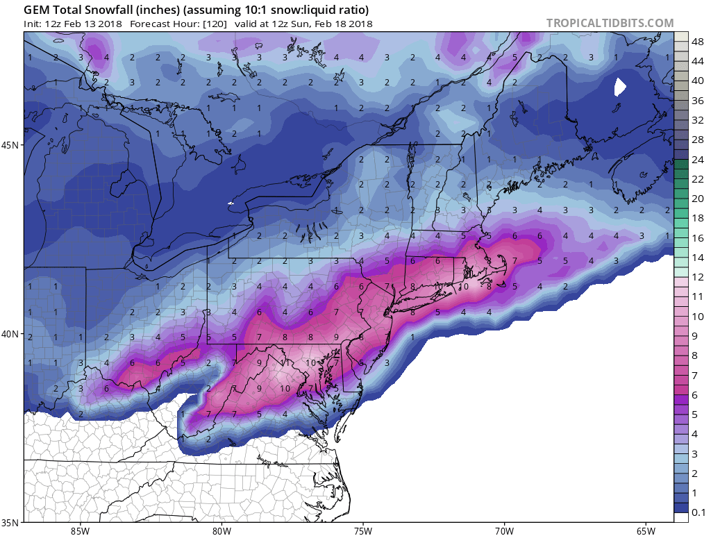
The Canadian model is laying down a swath of snow from northern VA and into Philly and NYC, CT Saturday night into Sunday. These accumulations are not exact, and include other forms of wintry precip. The point is that the band of snow could fall from Northern VA, MD, PA, NJ and into Southern New England.
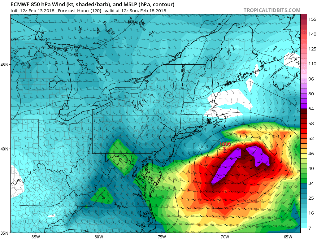
The Euro has the storm offshore as it intensifies once it moves over water. However this track is not exact, and could hug more of the coastline as it brings snow to the I-95 corridor.
The Canadian has the changeover line from rain to snow a bit further to the north and west than the snowfall model indicates. Either way, a swath of snow will be left in the Mid-Atlantic by Sunday.
Stay tuned here to East Coast Weather Authority for the latest!
You must be logged in to post a comment.