
At first, it did not look like the GFS model wanted to play nice with the Northeast snow potential this weekend. Now, the model is finally on board with some snowfall for the Northeast Saturday night into Sunday. Timing is hard to say at this point, but it looks like the snow starts across Philly and DC Saturday evening, perhaps just before dark in DC and just after dark in Philly. Timing is an extremely difficult thing to predict, even with 3 or 4 hour windows. All we know is that it starts sometime Saturday night. Both the Canadian and GFS are on board, but with a borderline rain-snow event for Philly and DC.
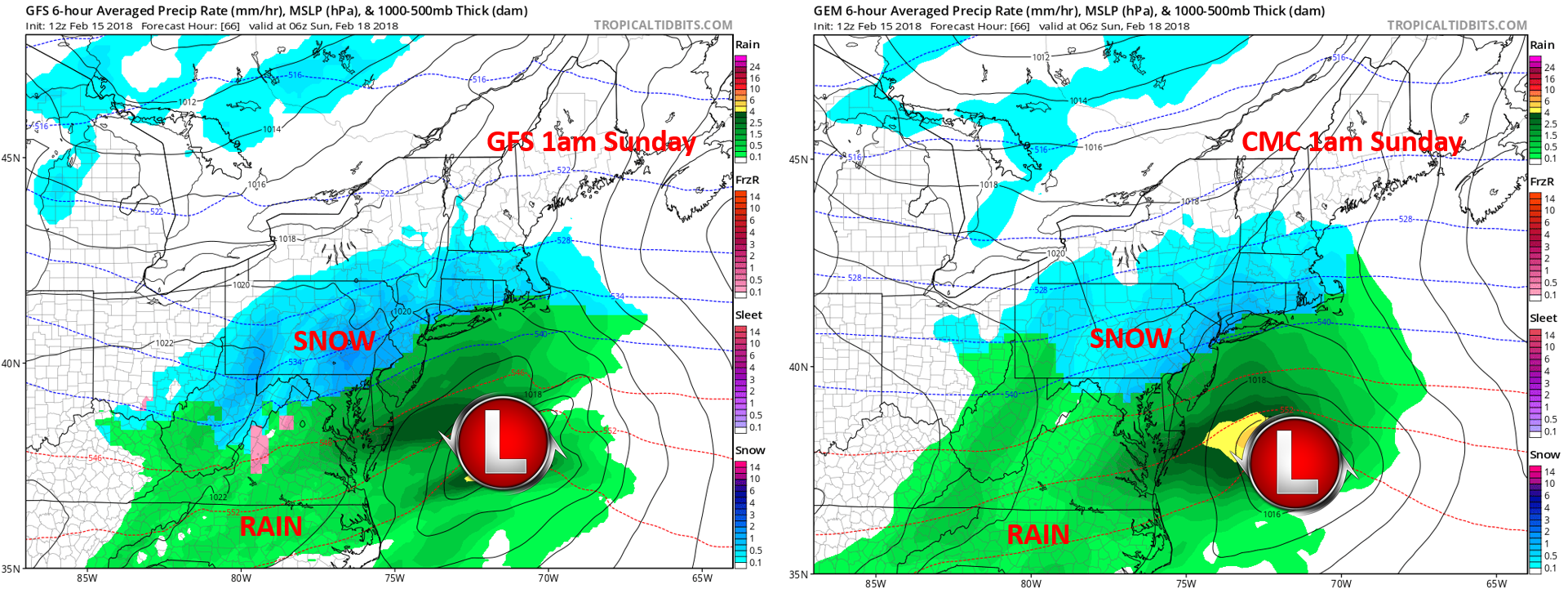
Total snow amounts are expected to be in the 1-6″ range, with less for DC and more for Philly. The Canadian puts down a bit less snow than the GFS.
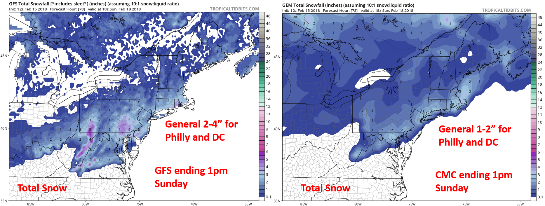
The reason we say a general 1-6″ is because the Euro has up to 6″ of snow across the Philly area. Keep in mind that sleet can drastically reduce these totals.

In all, something is going to happen Saturday night in the way of wintry precip and snow. DOTs, property owners, and snow removal contractors should take notice. Up to half a foot could fall across Philly. Less for DC as of now.
Things will change and snow forecasts always typically change as we get closer to the event. Please keep it tuned right here to East Coast Weather Authority!
-Meteorologist Mike G.
You must be logged in to post a comment.