
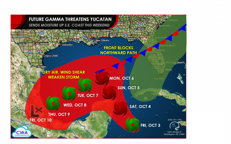
Tropical Depression 25 formed late Friday morning over the northwestern Caribbean Sea and looks likely to strengthen up until landfall over the weekend over the northeastern Yucatan Peninsula. Very warm ocean water and lowering wind shear are allowing for ideal conditions for strengthening up until landfall Saturday afternoon or night. Current National Hurricane Center forecasts show our likely 24th storm of the season forming by early Saturday to the southeast of Cozumel. It would be the earliest named 24th storm on record, beating the record pace of the 2005 Atlantic hurricane season.
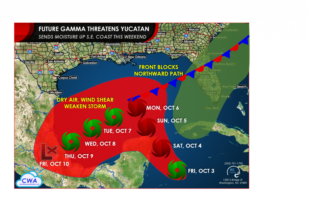
While not explicitly shown in the National Hurricane Center forecast, we have reason to believe the storm could attain hurricane status if it avoids too much time over land this weekend and early next week. This could even happen right at landfall near Cozumel or Tulum according to some regional hurricane models. The majority of our models do not have a firm grasp on the track of the storm after Sunday, but our best guess is for the front in the central Gulf to act as a fortress for the northern Gulf states. There’s a small chance this does not happen, so residents on the northern Gulf coast should not dismiss the threat of a storm next week, but right now that isn’t looking likely unless wind shear were to weaken substantially and the storm were to grow enough to overtake the front and weaken the high pressure ridge near and to the east of Florida.
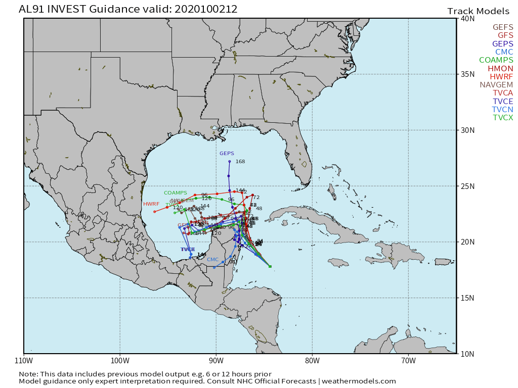
There is growing uncertainty of strength and path early next week as steering currents collapse. Some models allow the storm to keep strengthening over the warm waters of the Bay of Campeche while others have it getting sheared significantly and losing strength. There is also a chance the center does not emerge over the Gulf, weakening over the Yucatan or southeastern Mexico. That would be good news for the Gulf states, but terrible news for southern Mexico and Central America, as devastating rainfall could occur.
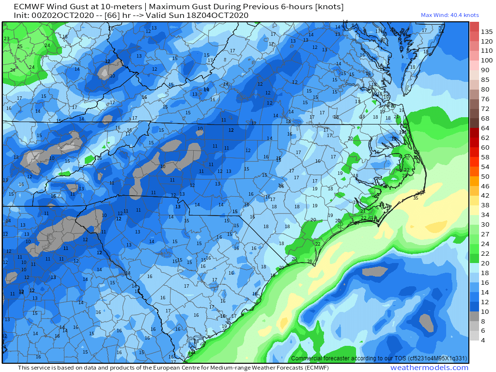
One thing does look more certain: moisture on the eastern side of the cyclone will get drawn northward into Florida for several days, producing locally drenching rainfall well into next week. Much of our model guidance brings a weak wave of low pressure up the Southeast coast this weekend, meaning clouds and rain will spread up the beaches over the weekend. Right now, most of the rain is expected to remain offshore. But model guidance is hinting at the potential for at least an inch of rain over the Outer Banks, mostly Sunday afternoon and Sunday night, moving away early on Monday. The GFS model is the most bullish, with 2-4 inches of rainfall potential shown, while other models show most of that rain falling just offshore Hatteras. Either way, the beaches will be cloudy, cool, and breezy.
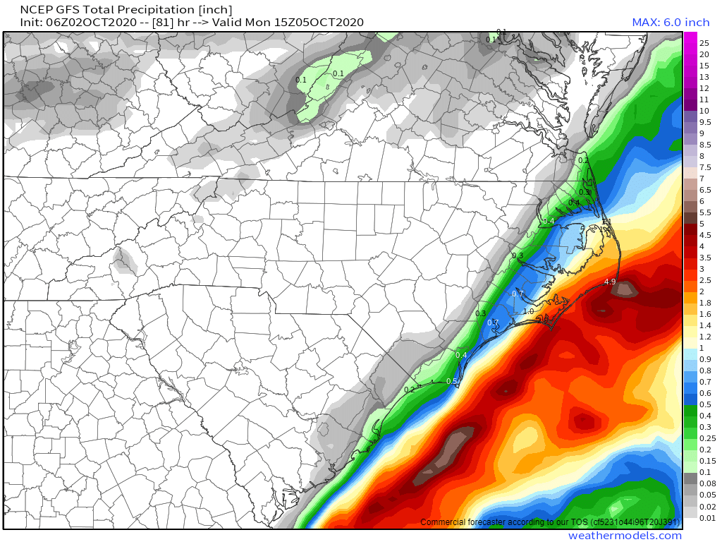
In addition to the expected rain, winds will pick up more over the weekend, with northeasterly winds potentially gusting to 35-40 mph over the Outer Banks on Sunday. Combined with the full moon, some coastal flooding could once again occur.
Our YouTube channel has more on what is going on in the tropics, both with this cyclone as well as potentially a second system developing next week, which we need to watch. Have a great weekend, y’all!
-CWA
You must be logged in to post a comment.