
After a brief shot of some overnight and morning fall-like temperatures, things will go back into the swing of summer later this weekend as a ridge of high pressure takes over. Fortunately, this will mean we dry out for the most part, but there could be some locations that need the rain.
The GEFS ensembles are indicating an upper ridge will begin to build on Sunday, setting the stage for heat and humidity.
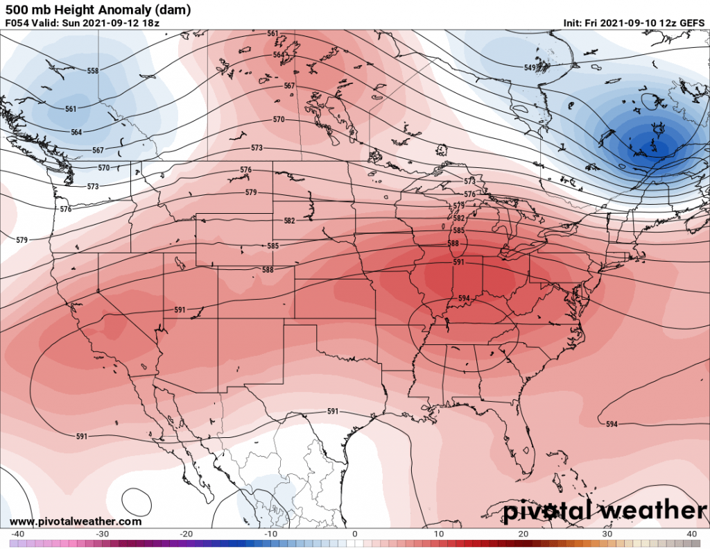
This is not expected to be an extreme heatwave, but highs will top out in the low 90s for many. Therefore, pool and beach season is still in full swing!
There does not appear to be any immediate tropical threat for the Carolinas for now, as it’s relatively quiet out in the Atlantic. Good news there.
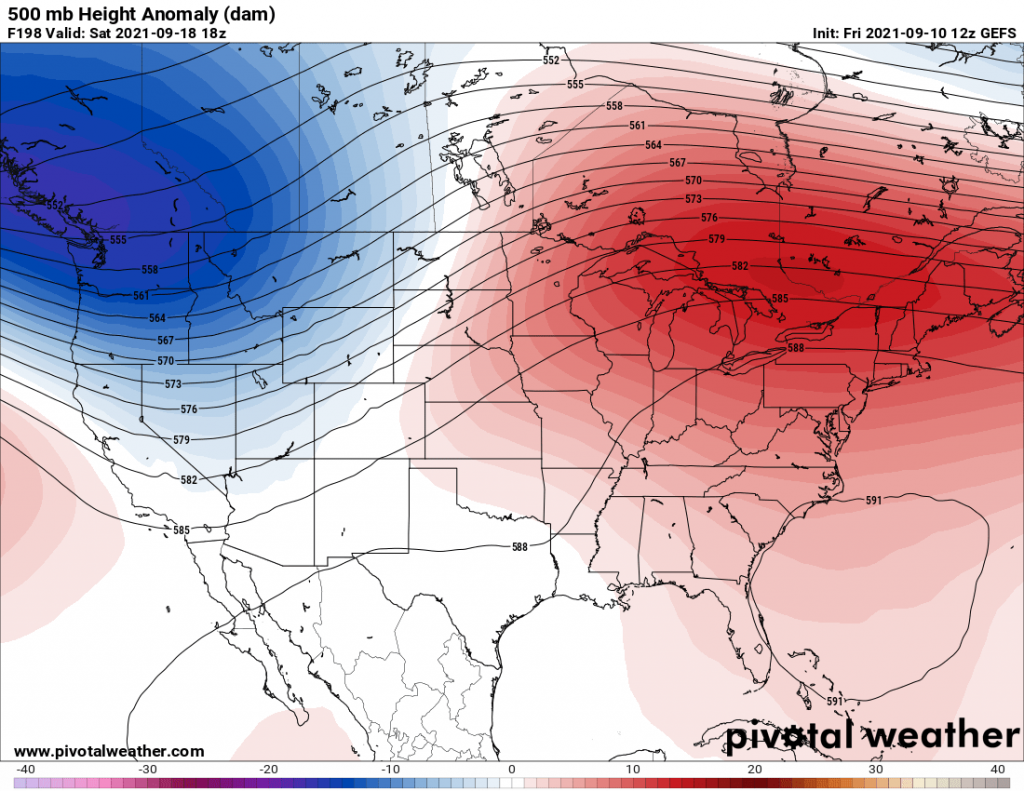
We could be looking at a more intense ridge of high pressure later this month, and these could be higher temperatures. This will be a “Bermuda High” centered just offshore.
All is quiet for now here in the Carolinas, just a slow return of the heat later this weekend. Enjoy the weekend!
You must be logged in to post a comment.