
Another week and another major storm that will likely bring heavy rain to the entire east coast to end the week. Starting overnight Wednesday into Thursday morning rain will begin in the Southeast and slowly work its way north up the coast.
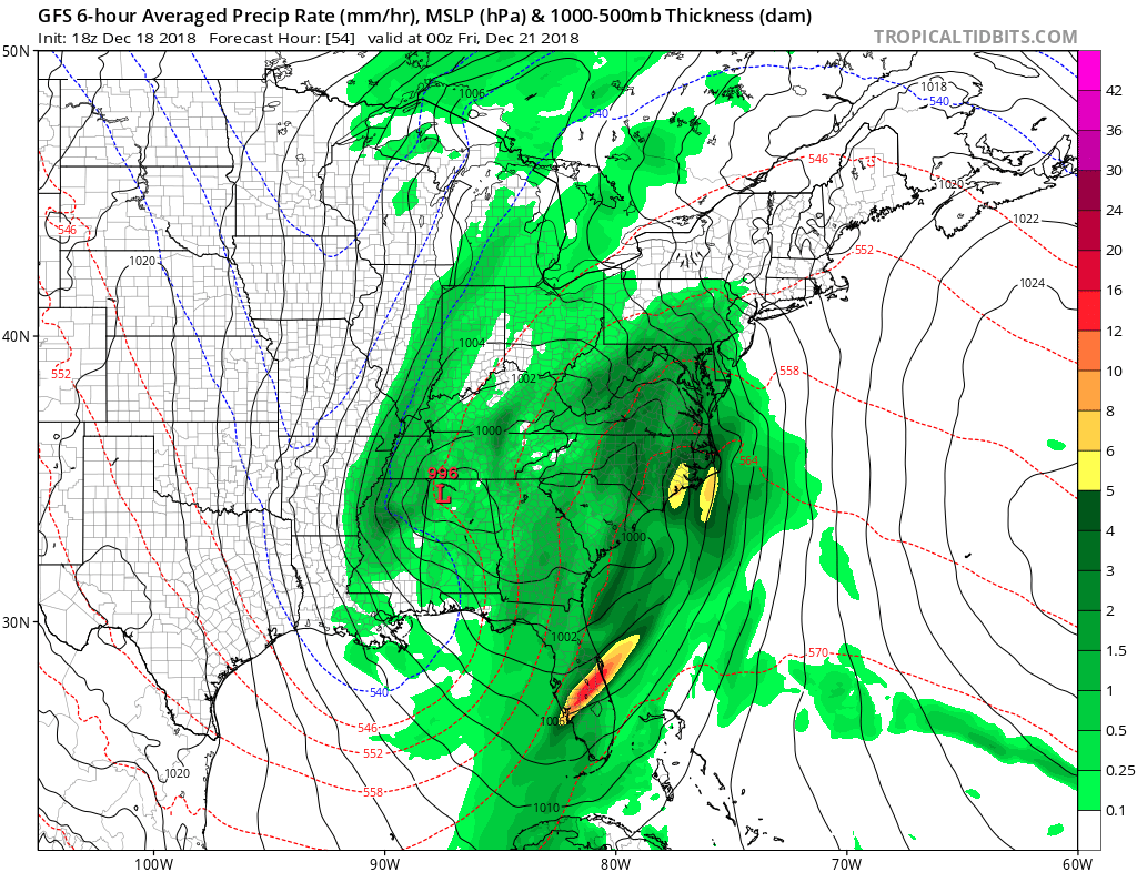
By Thursday afternoon the center of the low will be sitting just west of the Carolinas keeping everything to the east of this location in the warm sector of the storm. This storm will stay inland but will just get close enough to the Atlantic ocean to tap into that warm moist air producing large amounts of precipitable water along the east coast from Florida to Maine.
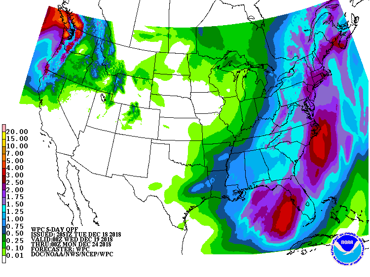
This slow moving system will be able to dump nearly an inch of rain for both the Mid-Atlantic and the Southeast with the largest amounts hugging the coast where 2-4 inches of rain is possible, thus resulting in a high risk of flooding. On the back side of the low pressure system cold air will be follow, allowing a good chance for rain to change to snow in higher elevations along the Appalachian mountains. This will result in minor snow accumulations of around an inch. Rain and snowfall will end in the Southeast mid day Friday and in the Mid-Atlantic overnight Friday into Saturday morning. Check back for your latest update on mother natures worst here at Easy Coast Weather Authority.
-Benjamin Charles
You must be logged in to post a comment.