
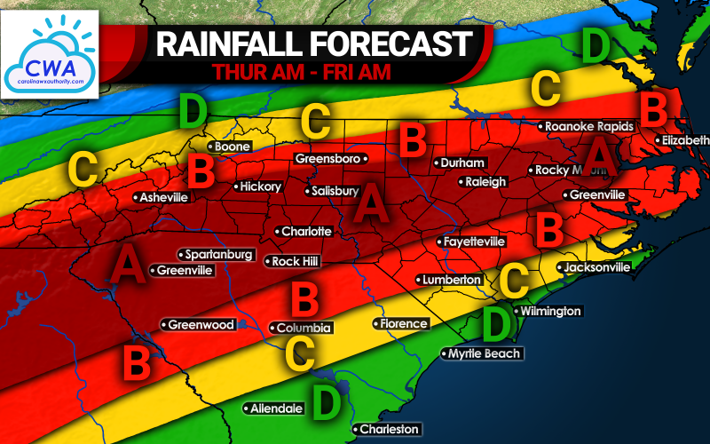
As if we need to say “more rain” is in the forecast, more rain is headed our way later this week from the remnants of Sally. While the impacts are not expected to be extreme, multiple inches of rain will cause flash flooding in spots since the ground is already saturated for some. The timing of the rain will be from Thursday morning into Friday morning. The heaviest rains will fall from the Upstate of SC to Charlotte to Raleigh. Please see the key below for the predicted amounts:
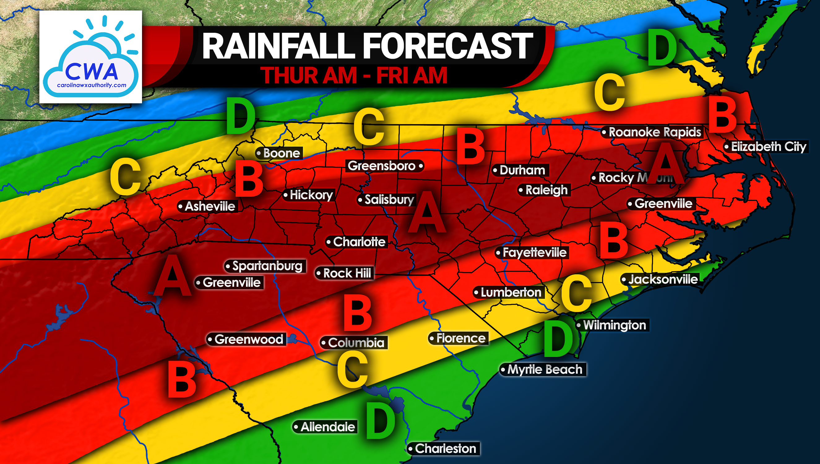
Area A: Rainfall totals of 4 – 6″+ expected. This area has the highest risk of flash flooding. Interstate travel along I-85 is not recommended as there could be big delays/accidents.
Area B: Rainfall totals of 3 – 4″ anticipated. There is still a threat for flash flooding, but not quite as high. Travel and outdoor activities will be disrupted.
Area C: Rainfall totals of 2 – 3″ expected.This will be a typical steady rain event, with downpours in some locations. Flooding risk in this area is low to moderate.
Area D: Rainfall totals of 1 – 2″ anticipated.This area will see the lowest flooding threat, and rain will be off and on at times. Areas where the rain is steadier could see some light totals.
Wind won’t be too crazy overall, perhaps a 25 mph sustained wind at the most with some possibly higher gusts. Rain will be more of an issue than wind.
Thursday during the day will not be ideal for travel or outdoor activities. If you must go out, use headlights even if it’s during the daytime if you’re using wipers. Again this is from Thursday morning into Friday morning.
Stay safe and check the radar on Thursday!
-CWA
You must be logged in to post a comment.