
After Sally made landfall as a strong Category 2 hurricane early this morning near Gulf Shores, Alabama, the storm is weakening as she moves northeast across far eastern Alabama and southwestern Georgia this evening. Winds at landfall were estimated at 105-110 mph, with 5-6 feet of storm surge and 2-3 days of rain which tallied 2-3 feet, breaking rainfall records in places like Pensacola, which remains submerged in flood waters. Sally made landfall on the 16th anniversary of the landfall of Category 3 Hurricane Ivan, which hit the exact same area, but had a faster track with much more certainty than slow-moving Sally has had.
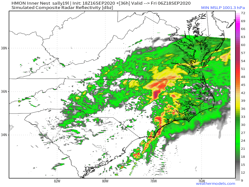
Rain will continue to spread northward across western South Carolina tonight, but heavier rain will hold off until daybreak. As the day unfolds Thursday, that heavy rain will spread northeastward across the spine of the Blue Ridge and points eastward as Sally weakens to a remnant low.
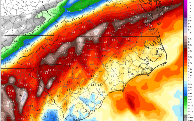
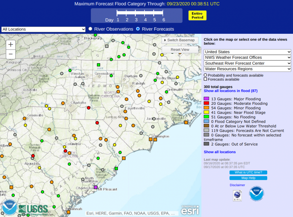
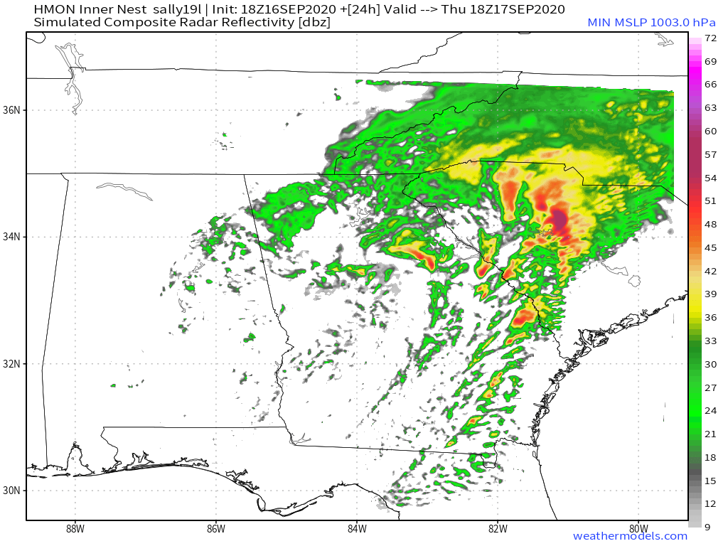
Earlier forecasts this week showed the remnant low tracking along the I-20 corridor across South Carolina, but recent forecast trends are now farther north and somewhat faster, meaning the heaviest rains could end up 25 or more miles north of the I-85 corridor Thursday and Thursday night. Locations in the bull’s eye look to be a zone from Gainesville, GA, to areas near and north of a line from Greenville, SC, to Lincolnton, NC to Martinsville to Williamsburg, VA. That zone is likely to see widespread amounts of 4-7 inches of rain in just a 24-30 hour period. Someone in that zone could pick up closer to 10 inches of rain, setting the stage for more minor to moderate river flooding, and likely to cause dangerous travel conditions. Winds are not expected to be that powerful, but some power outages could occur in the zone of heaviest rain.
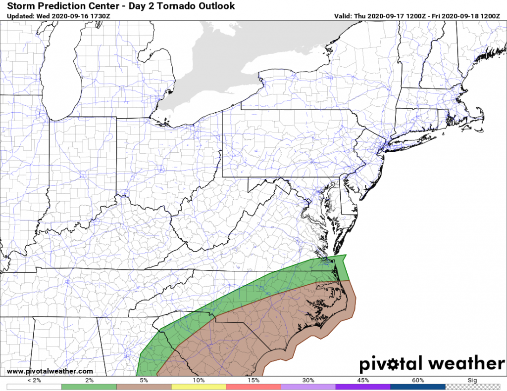
With the expected further north track of Sally’s center comes the increased probability for severe weather, mainly localized strong winds and tornadoes near and to the east/south of the low pressure track.
Dewpoint values which were comfortable earlier today in the 50s and low 60s look to climb well into the 70s along and to the south of the low pressure track during the afternoon Thursday, providing the moisture needed for bands of showers and strong to severe thunderstorms.
The risk for severe weather including a few tornadoes looks to ramp up over the SC Midlands and approaching Charlotte’s southern suburbs during the afternoon hours, and advancing northeast into northeastern SC including the Grand Strand and the southern NC Piedmont, Sand Hills, Cape Fear Region and southern Triangle Thursday night.
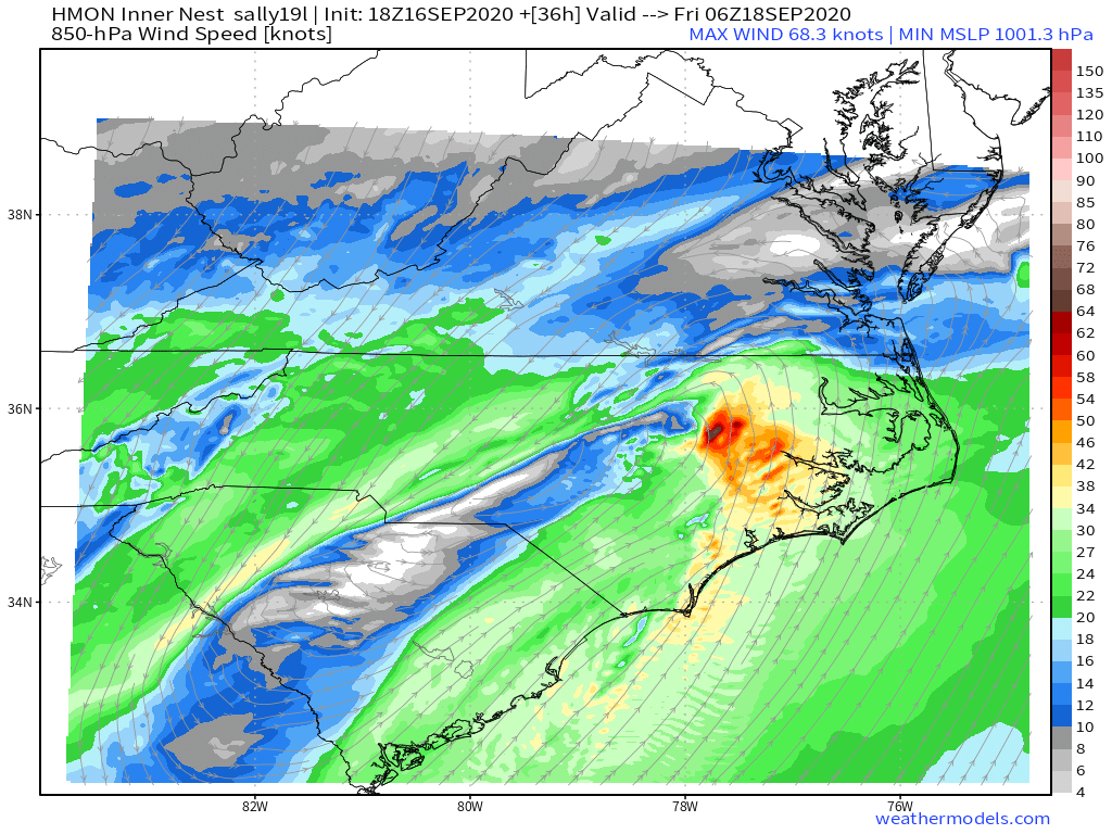
Tornadoes could still occur across eastern NC well after midnight as jet stream energy remains high enough for a few discrete supercells that could have rotation with them.
The good news is that the faster timing of the storm’s arrival will mean a faster drying trend for Friday. While some rain will be possible in the morning, conditions should begin to dry out starting in the southwestern part of the region. But it may take a little while longer to get the dampness out of the air, until a strong cold front moves into the western Carolinas Friday night, and slowly crosses the eastern half of the region on Saturday, setting up an extended period of cool and comfortable fall-like weather for Sunday and much of next week.
But don’t get lulled into a sense that this will be it for the tropical season. A look into the future for the end of the month of September and into the first several weeks of October shows that the tropics look to remain active. Storms like Hazel, Matthew, and Michael were all October problems in the Carolinas. And with all the rain we are having now, you’ll want to remain vigilant, especially if you live in a river flood plain or on/near the coast.
-CWA
You must be logged in to post a comment.