
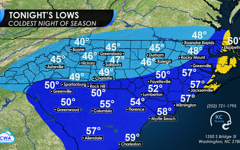
It seems as though summer is winding down for 2020, and the temperatures tonight will certainly feel like it. A stiff northerly wind today will usher in some of the coldest temperatures so far this season, and they will be around at least in the short-term before bouncing back to near-normal later this week.
Much of the viewing area will dip into the upper 40s across NC, and in the 50s for much of SC and eastern NC. Some spots in the mountains could fall below 40° tonight, especially in the higher elevations. You may need a jacket or coat if you wake up early on Sunday morning to go outside.

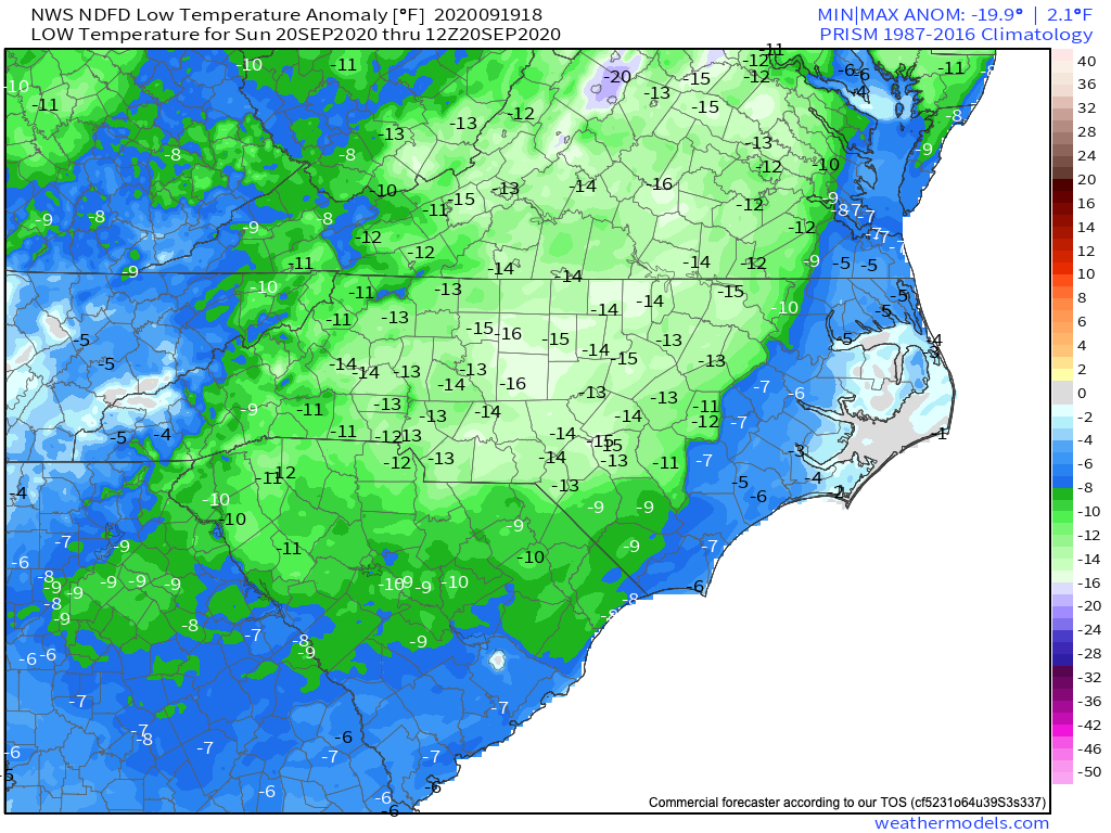
Is this early season chill unprecedented for our area? Not completely, however it is a bit early this year, as temperatures will be some 15° below normal. Normally we don’t see this kind of cold until October. Low temperature anomaly for tonight:
This early season chill will stick around at least through Thursday of next week before the airmass modifies and brings us closer to normal temperatures by next Friday. If you are a cooler weather lover, rejoice, as this will be your next 6 days or so!
Make sure to bookmark our models page so you can follow along: https://carolinawxauthority.com/models
You must be logged in to post a comment.