
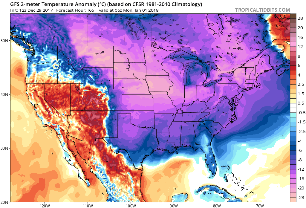
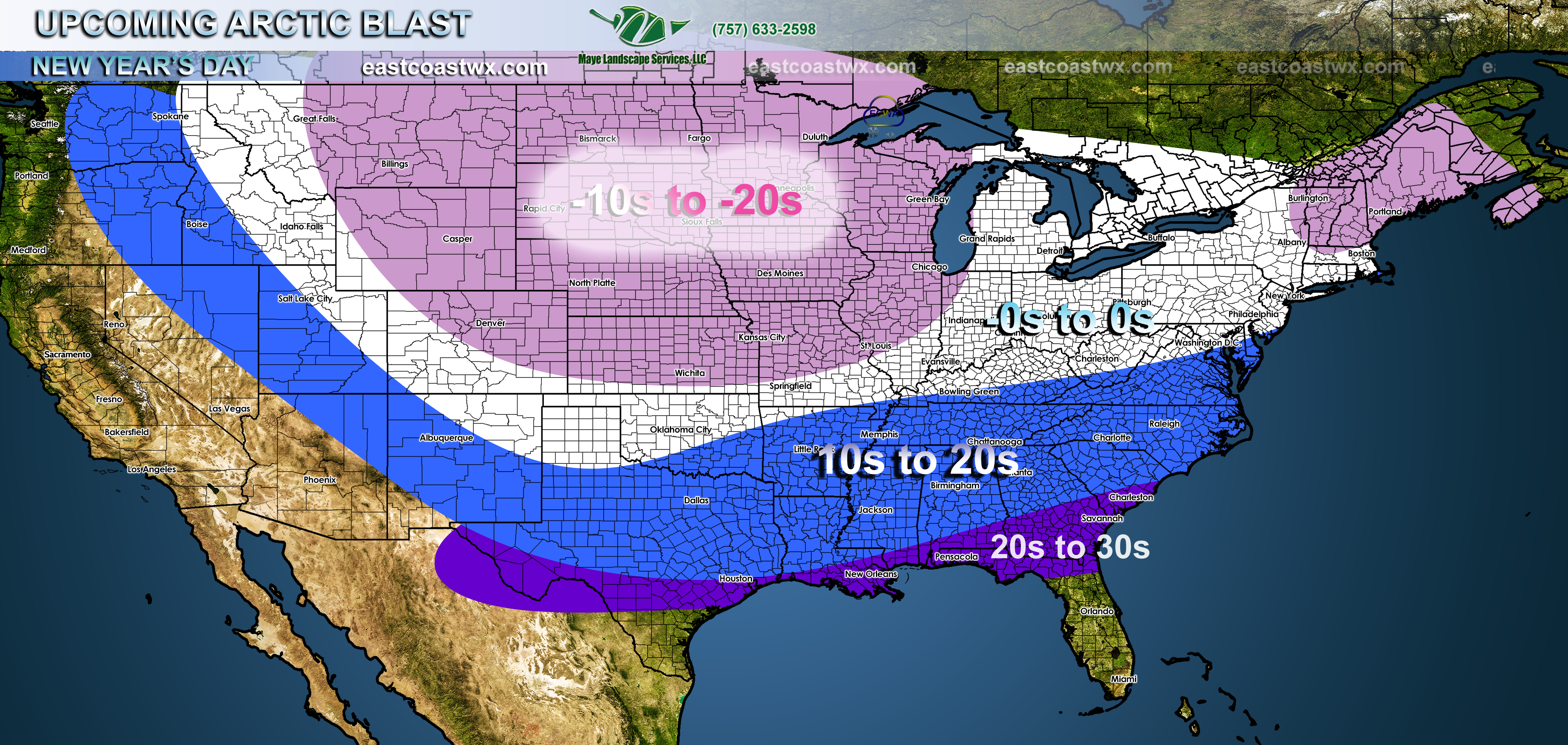
Some of the coldest air in recent years will intrude much of the central and eastern half of the U.S. Overnight lows into the morning on New Year’s Day will be in the -20s to -10s across the northern Plains states. Single digits and negative single digits will grip the Northeast U.S. Single digit lows will likely extend all the way into Atlanta and Charlotte. Some hardships will likely occur from the freezing cold, such as pipes freezing and bursting, power outages due to the strain on power grids for heat, car radiators bursting, and other hardships.
Temperature departure from normal according to the GFS for 1/1/2018 (first image), also forecast from here at ECWA (second image) –
You may click any image for larger version
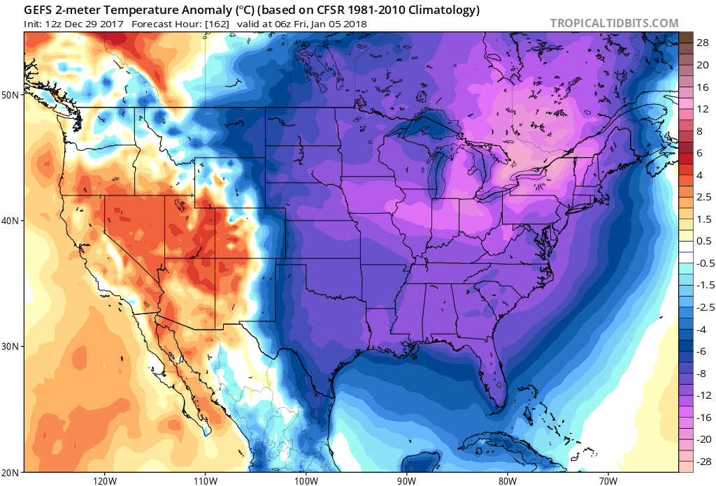
The cold most likely lasts into the 5th (first image). Therefore this cold snap will seem to linger a bit longer than what most people want.
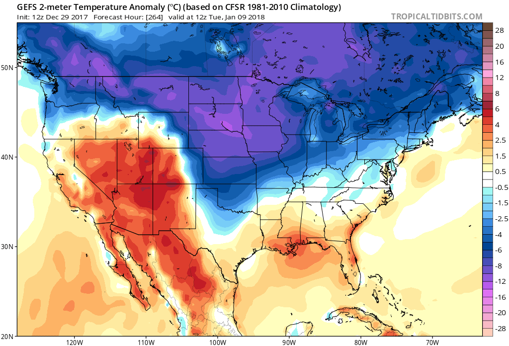
The only reprieve from the cold will come after the 8th or 9th, as temperature will not be as severely cold. Shown is the GEFS for the 9th, which indicates a lot of the bright purple being lifted from the eastern U.S.
Take precautions now to protect your pets and livestock, as well as leaving water drip so pipes do not freeze. The “emergency heat” option should be used if it is available on your thermostat. Car and truck batteries will die if not charged properly in the cold. Protect yourselves by dressing in layers as well as hats, gloves, and scarves.
For more info and more frequent updates, please join us as a member for 5.50 a month, also business sponsorships avialable here:
https://carolinawxauthority.com/subscription-options
-Mike G.
You must be logged in to post a comment.