
We will have a chilly Sunday night tonight into tomorrow morning, as gusty winds are ushering in cooler air. This will not be anything unusual, as it is just a return to normal temps. This week ahead also looks warm, but only up until 12/1 which is Thursday. We then expect a widespread cold shot. Morning lows will dip back into the 30s for our region. This will last into Friday 12/2.
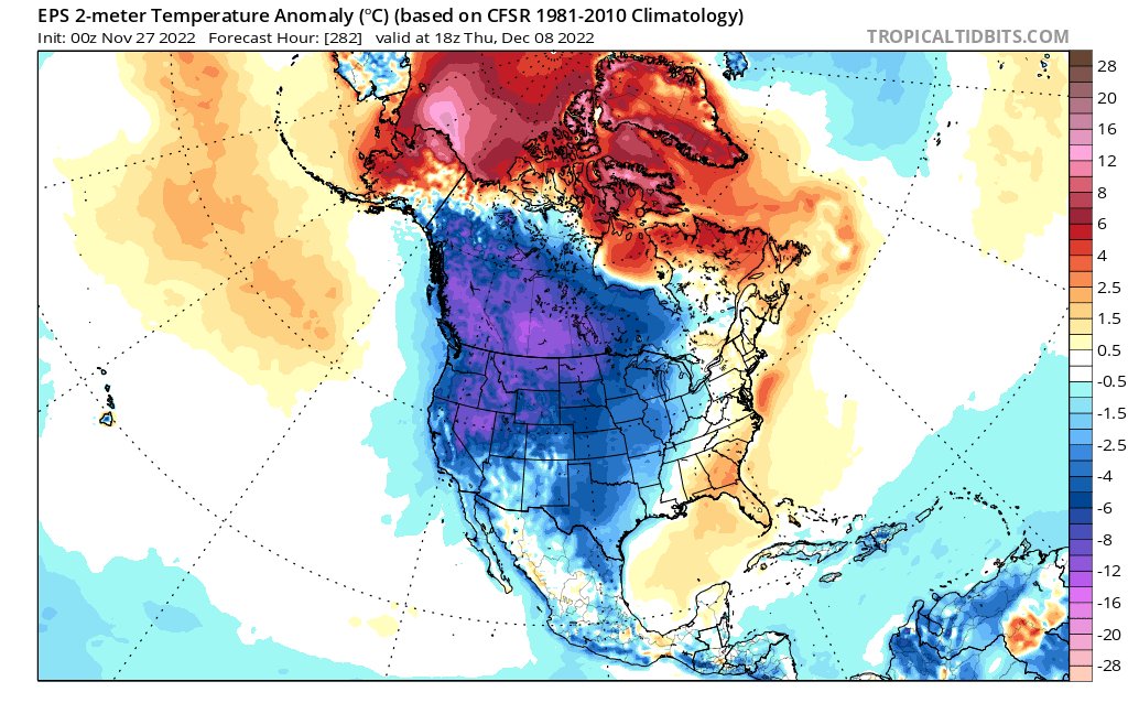
But after then, temperatures quickly rebound, and daytime highs become warm enough to not wear a coat for some. After the 8th or so, things become fuzzy.
There is chatter of a major polar vortex split, so things could get interesting mid-month. This is just chatter however. Also, it looks like high-latitude blocking will take shape in early December, but other factors at play may limit how much cold we get, and ultimately wintry precipitation.
No telling for now. However, cold lovers will welcome when the calendar turns December!
You must be logged in to post a comment.