
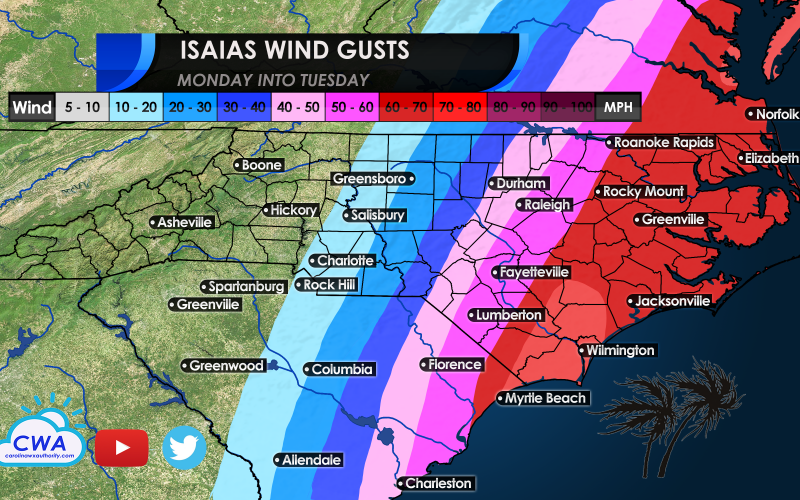
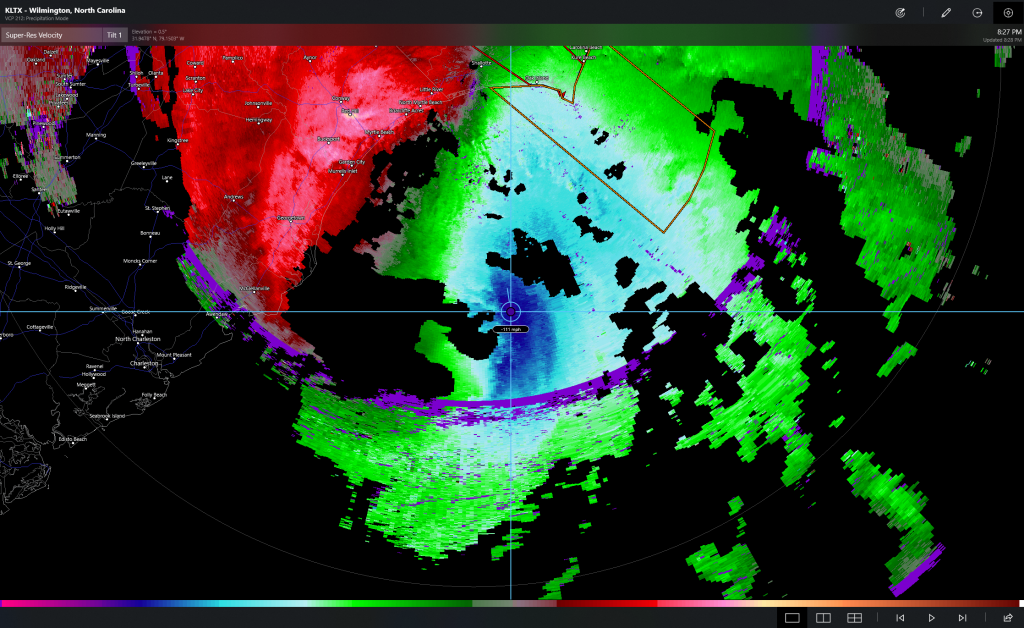
Hurricane Isaias was recently upgraded as Hurricane Hunter aircraft reached the center on its last reconaissance mission Monday evening, finding winds had topped 75 mph and were expanding over the northern and eastern part of the storm’s circulation. Radar from Wilmington indicates that winds at radar height have exceeded 110 mph, a big jump from Florida radar data yesterday when the storm was at a similar distance from the coast. Isaias could strengthen right up until landfall just after midnight near the NC/SC border.
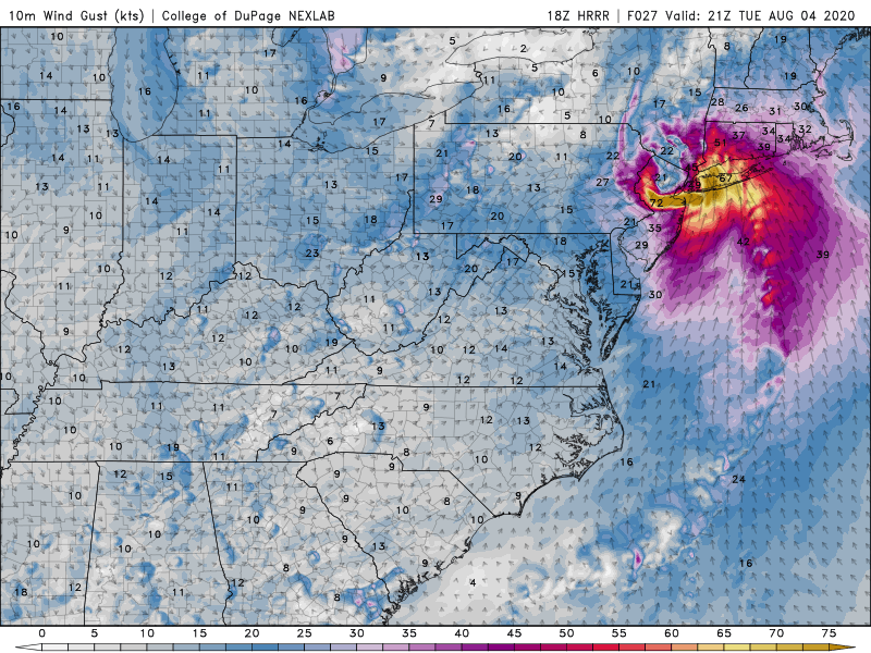
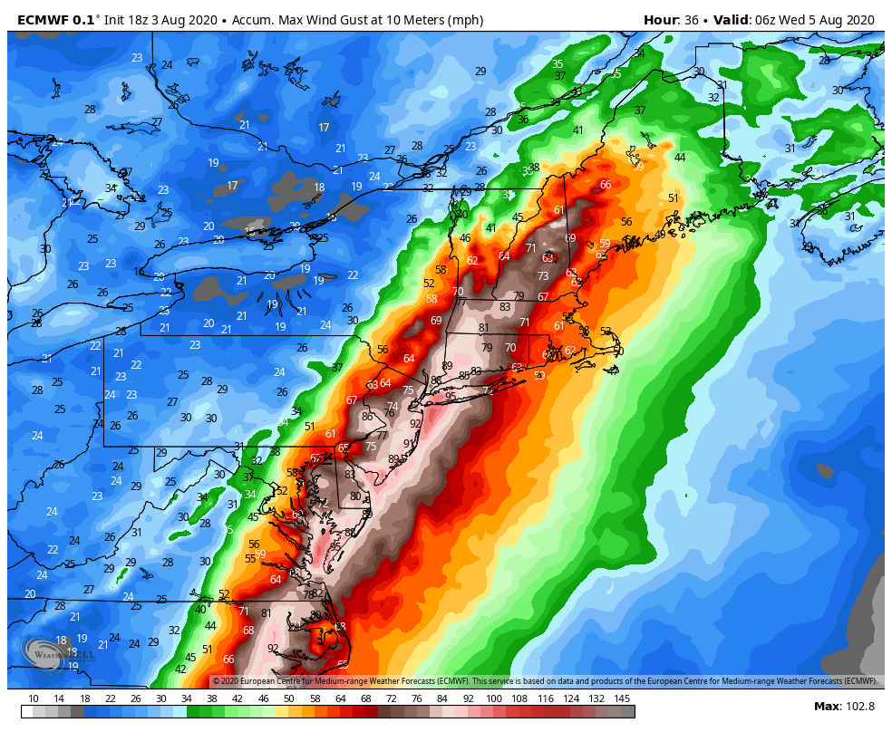
The reason for the strengthening is a subtle drop in wind shear and enhanced low-level jet stream energy as a trough moves southeast into the Eastern states tonight. This will keep the center of the storm well in tact several hours after landfall and cause widespread wind damage near and to the right of the storm center. Recent model data indicates wind gusts of hurricane force could accompany the storm right up the Eastern Seaboard Tuesday morning and into the highly populated NYC area later Tuesday afternoon, causing damage to areas that were hammered hard by Hurricane Sandy in 2012. While winds should be lower than they were in Sandy’s case, the increasing forward motion over the coastal plain will bring a huge punch with it, and could impact over 50 million Americans. Tornadoes will also be possible along and east of the storm track and could impact several states.
While much of the coast is under storm surge and tropical storm warnings, individual tornadoes and wind gusts will be hyperlocal and predicting where they occur will be next to impossible. Thus it would be smart to prepare for the worst possible conditions.
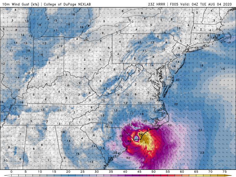
The European model below is the high end possibility of what could occur as Isaias is strengthening up until landfall overnight.
Conditions will deteriorate quickly tonight as Isaias moves inland. With power outages possible, it is recommended to have a NOAA weather radio on hand in the case of tornado warnings and flash flood emergencies that could evolve in precious minutes of time. In addition, we will keep you posted on the latest on our Facebook page with live updates.
Be safe!
-CWA
You must be logged in to post a comment.