
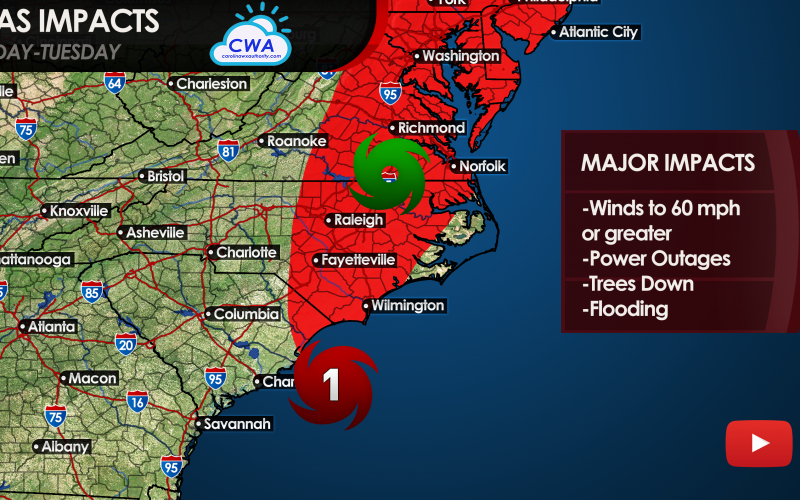
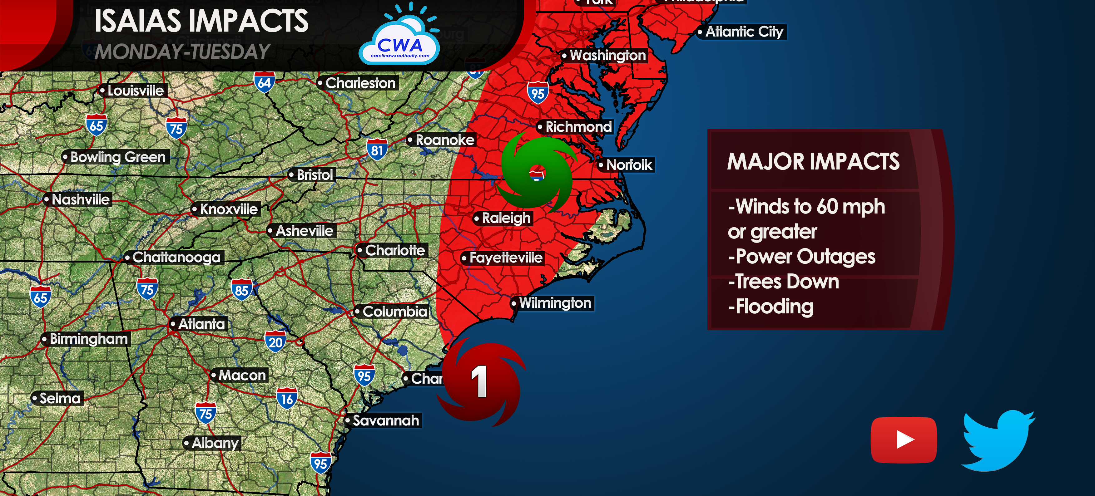
Isaias is currently a tropical storm as of 1:59 pm Monday, however he may be upgraded to a category 1 hurricane with the 2pm advisory. If not, then he may be at some point today. He will either make landfall as a strong tropical storm or minimal category 1 hurricane tonight.
Once inland, the impacts will not cease as he races off to the north and east. Downed trees and power lines will be a common site from Wilmington to Maine. Widespread power outages are also likely, so be sure to charge your wireless devices.
Conditions will become dangerous tonight, especially from Myrtle Beach to Wilmington and surrounding areas. Wilmington and nearby beaches will get the worst of the storm, since the worst conditions are typically on the east side of a tropical system. Expect storm surge and high winds, and tornadoes. Tornadoes could range from Wilmington to Jacksonville or even farther north.
Have a way of receiving urgent messages and consult your local NWS for all pertinent information.
You must be logged in to post a comment.