
Hi Members,
Hope nobody is freaking out just yet. I does look like Miami and South Florida will be spared from the worst, but now the question is who will get it instead? Well, the recent trend has been east, and that’s not good for the Carolinas or Virginia. Especially if Irma remains over open water and the warm Gulfstream currents just offshore. This means that she will maintain her strength, or even strengthen further if she weakens some.
An excellent short-range hi-resolution model is the HWRF or Hurricane WRF. Basically it is the NAM model but upgraded to handle hurricanes. It is much more reliable than the GFS or Euro.
It has Irma just offshore of Florida just like Matthew. Here is the model image from next Monday morning, September 11th:
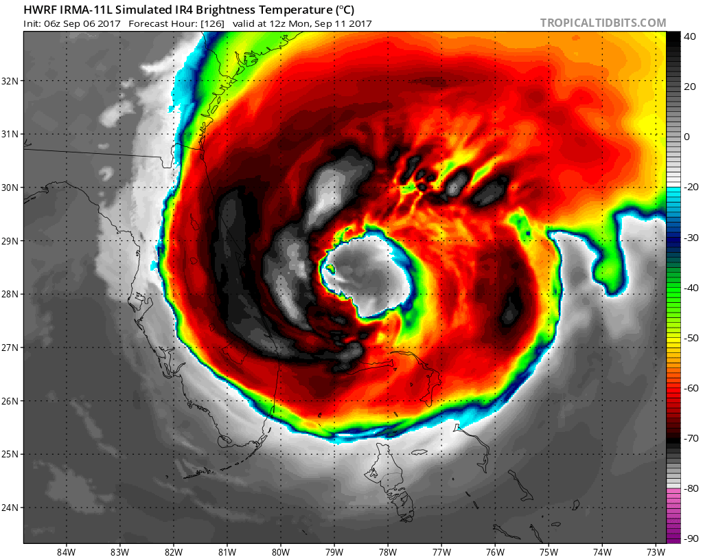
She will remain VERY strong and dangerous as she moves into the Southeast US waters. Then she will likely continue on a track to the NORTH, but the NHC does not have this in their forecast yet.
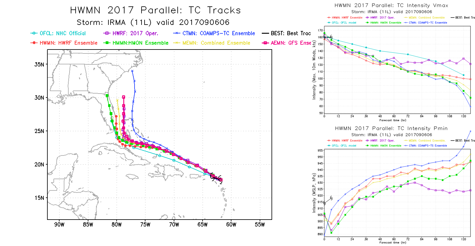
Here is some good stuff, the HWRF ensembles. Basically she will be on a northward track once she nears Florida. I would say for coastal SC, NC, and SE VA to look out and think about starting to prepare. Fortunately, she weakens SOME as she moves north! Hopefully this will ALSO be the trend!
You must be logged in to post a comment.