
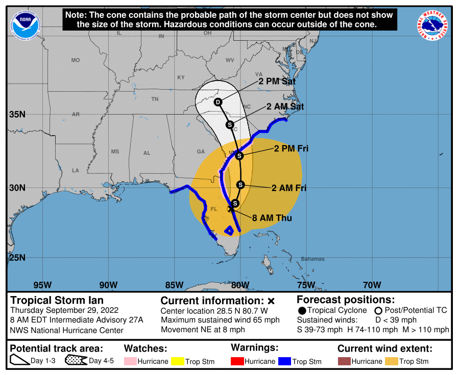
As Hurricane Ian tore across Florida yesterday, he will now re-emerge in the Atlantic as a tropical storm. He is expected to gradually strengthen into a stronger tropical storm today and tomorrow, and become a strong tropical storm before slamming into the South Carolina coast.
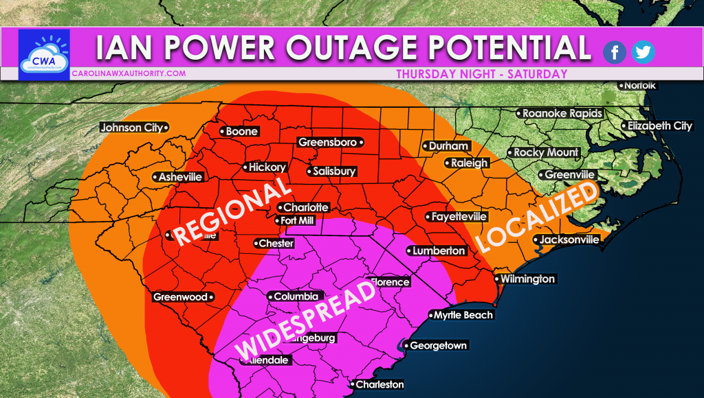
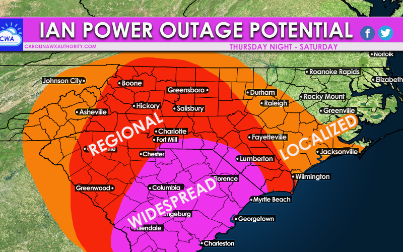
As Ian hits a colder air mass on top of us right now, the wind field will expand. As a result, widespread power outages are likely across SC due to strong gusty winds in excess of 55 mph. Tornadoes are also very possible in northeast SC and southeast NC.
As Ian moves inland, he will weaken but winds will still be gusty. Power outages will be regional in the red, meaning some will lose power depending on location, but there will be a lot of locations within the region.
Localized power outages are likely in the orange, but scattered. Winds are not expected to be as strong as in the purple and red.
Winds are picking up today so charge your mobile devices and plan for possible extended outages!
You must be logged in to post a comment.