
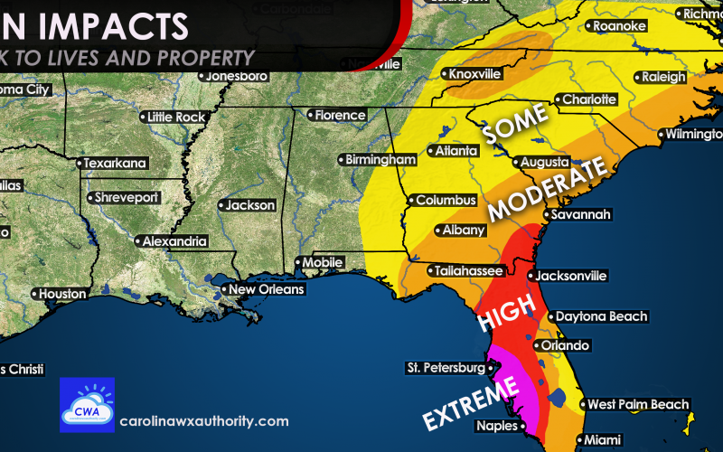
Ian is on his way, and will potentially devastate parts of the west coat of Florida. Currently, Ian appears to be heading for Cape Coral, but could hit anywhere between St. Petersburg and Naples tomorrow (Wednesday) afternoon. This area will see extreme impacts in the way of structure damage, storm surge, loss of life, and extended power outages.
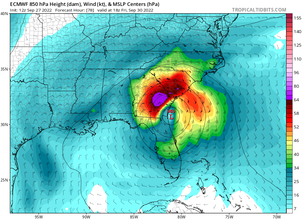
The European models have been somewhat right all along, and could have caused confusion with the “cone of uncertainty” from NOAA. While this cone should be considered official, the forecast track can change, and has been often with this storm.
The Euro, below, shows pressures and wind at 5,000 feet in the atmosphere. Ian looks to re-emerge into the Atlantic and then come back onshore somewhere in South Carolina or Georgia on Friday.
Therefore, moderate coastal impacts are expected for both NC and SC in the way of flooding, winds, and tornadoes, and storm surge. Power outages are likely. Heed all warnings and watches by the NWS and NHC. Moderate impacts are expected in the NC mountains, with flooding rains and possibly mudslides.
In the yellow, some impacts are expected across the rest of the region, in the way of heavy rain and some flooding. There also could be scattered power outages but not like in the orange.
Timing is Friday and Saturday for the Carolinas. Strap down or take inside any loose outdoor objects.
Florida is under the gun over the next 2 days for a major hurricane. Hopefully everyone that was told to evacuate there did. This will be an eventful week, and we urge everyone to stay safe however they can.
You must be logged in to post a comment.