
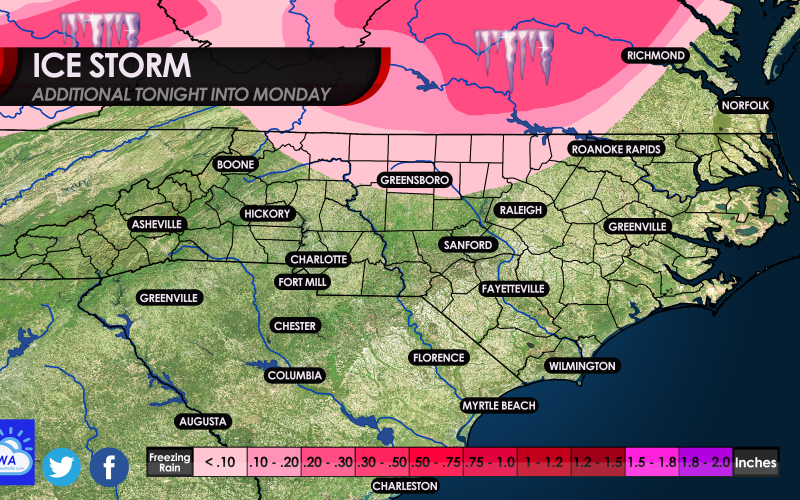
An ice storm is underway for much of south central Virginia today and tonight, with trees and powerlines sagging under the weight of ice. Anywhere from Richmond and west, and along the NC/VA border will be hardest hit. Please note, our latest graphic includes ADDITIONAL ice accumulation and is not the storm total, so overall amounts will be higher when this event is over.
Trees are starting to sag under the weight of ice across Virginia.
Extended power outages and impassible roads are expected at least into early Monday if not longer. If you are home, it is recommended to stay there since roads will be impassible. Traffic accidents will be widespread, including on the interstates. Anywhere in the pink, even the light pink down into NC will be places to avoid over the next 2-3 days.
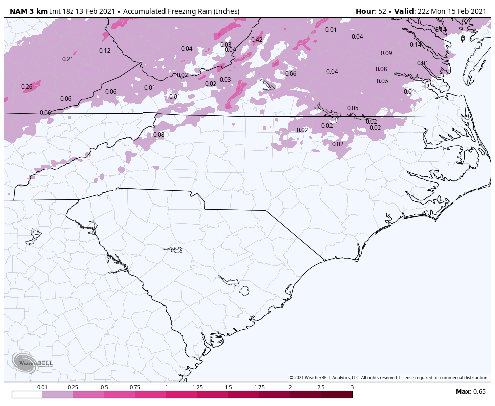
Below is one computer forecast model for additional expected freezing rain from now into Monday. Raleigh and north and especially Greensboro will remain slick tonight into Sunday.
Ice storms are fascinating but also extremely dangerous. If it’s quiet outside and you can hear a pin drop, and it’s drizzling, chances are it’s freezing drizzle or freezing rain and icing is occurring. There is a certain stillness outside with ice storms.
Do not use open flames if the power goes out, and use space heaters with extreme caution since they can start fires. The fire department may be overwhelmed with calls due to power lines being down, and other space heater fires. Don’t think they can come to you quickly!
Stay safe throughout this event if you are in the ice storm zone.
You must be logged in to post a comment.