
Significant icing is possible tonight across the western mountains of Virginia and North Carolina. This will be the zone of the highest threat for an ice storm. Also, if you’re in PA and the Philly suburbs, keep an eye out tonight for ice that may mix with snow and sleet, making for a treacherous commute if no cancellations.
Elsewhere across the South, residents should make sure to check road conditions before driving tonight or Wednesday morning.
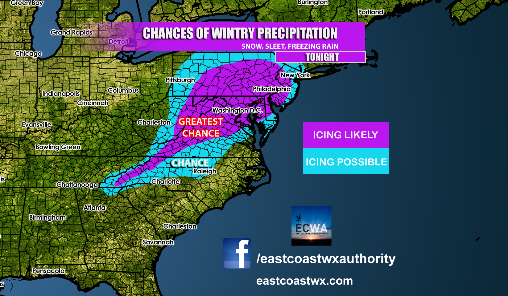
Model snow and sleet extends from the northern GA mountains to Raleigh and up I-95 to DC and Philly. Remain aware of road conditions along these areas overnight and into the morning hours. Do not be caught of guard if you live in the NC Piedmont and there is ice, even if it cannot be seen on the road (black ice). If it is icy, it’s best to stay home.
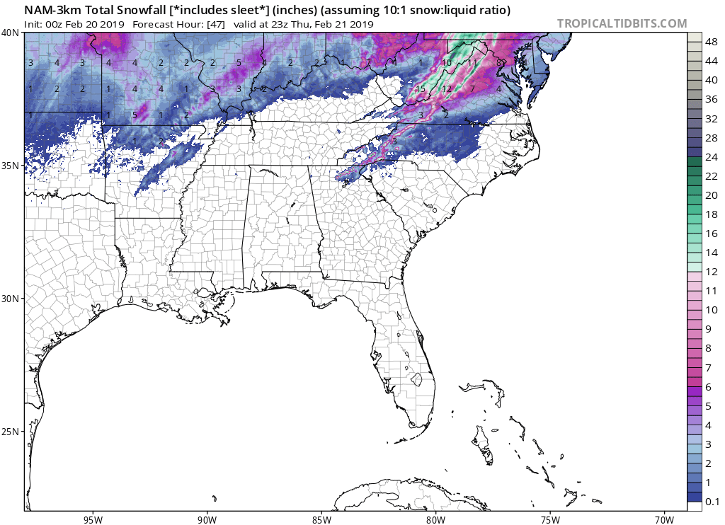
The future radar may not be accurate as there is mixing occurring across the NC Piedmont tonight. By sunrise, most of NC could be all rain, however VA will still see snow and ice. DC and Philly won’t see the storm arrive until later in the day.

Be safe and report your conditions on our Facebook page.
-ECWA
You must be logged in to post a comment.