

WINTER STORM POSSIBLE AROUND CHRISTMAS WITH SNOW SLEET AND FREEZING RAIN
The GFS has a classic ice storm set up from Kansas to Michigan, however this medium range forecast is not to be taken verbatim. The extent of the ice may be more than what is shown in pink. All the blue is snow. This looks like an overrunning pattern, where warm air from the Gulf is overriding colder air over the Plains. If temperatures hover around freezing, watch out. This is only something to watch for now and it is only one scenario.
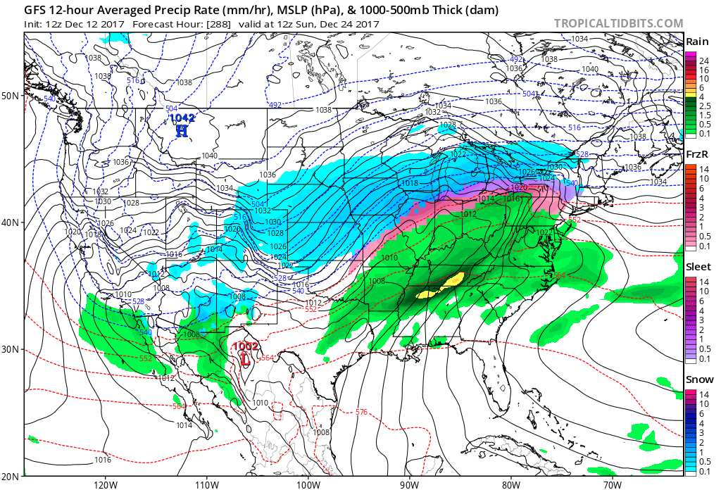
Also, the GEFS ensembles are pointing at cold air spilling into the Plains, and could be a source of cold air damming, which is a decent setup for ice storms. It looks warm in the Southeast as a ridge could take shape. One thing is with higher confidence, the western US will be freezing all the way into Texas. We will see if that cold air will make it east. We could all still be in the freezer on Christmas, except for those along the East Coast, under a ridge. This is a typical La Nina pattern.
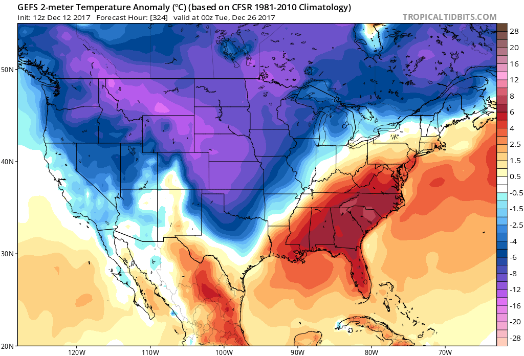
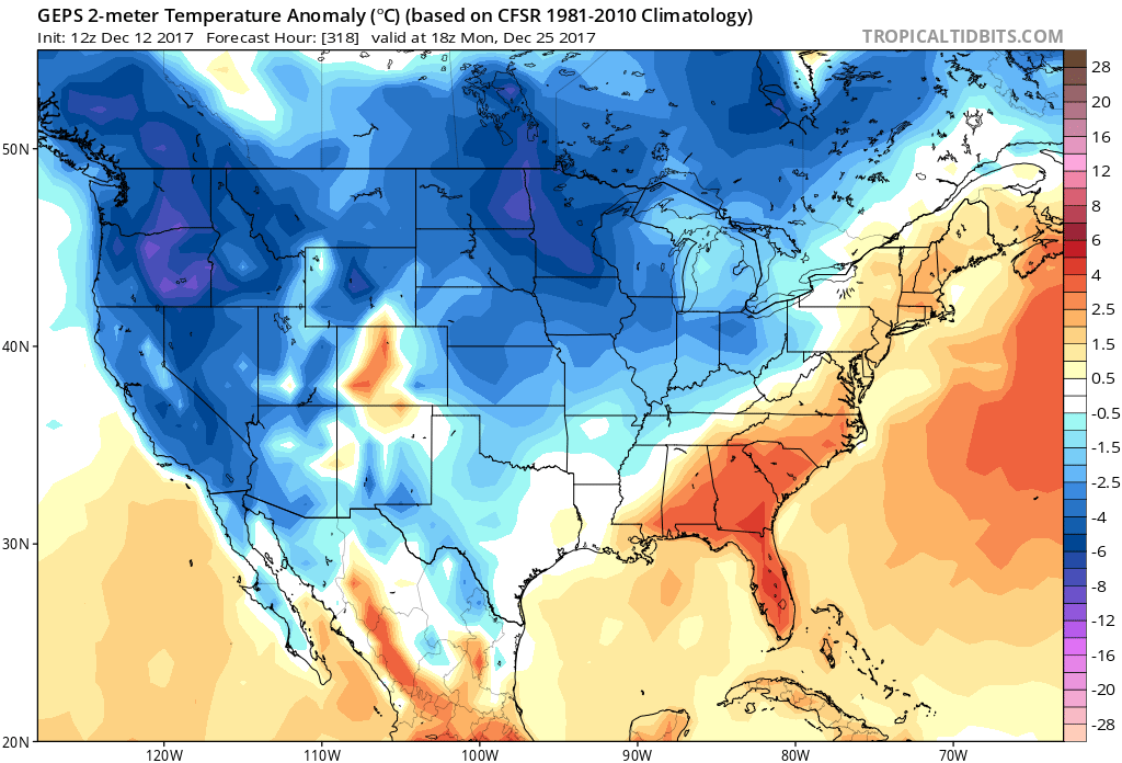
Christmas is looking warm and dry in the Southeast and portions of the Mid-Atlantic. The GEPS or Canadian ensembles are in agreement.
-Mike G.
You must be logged in to post a comment.