
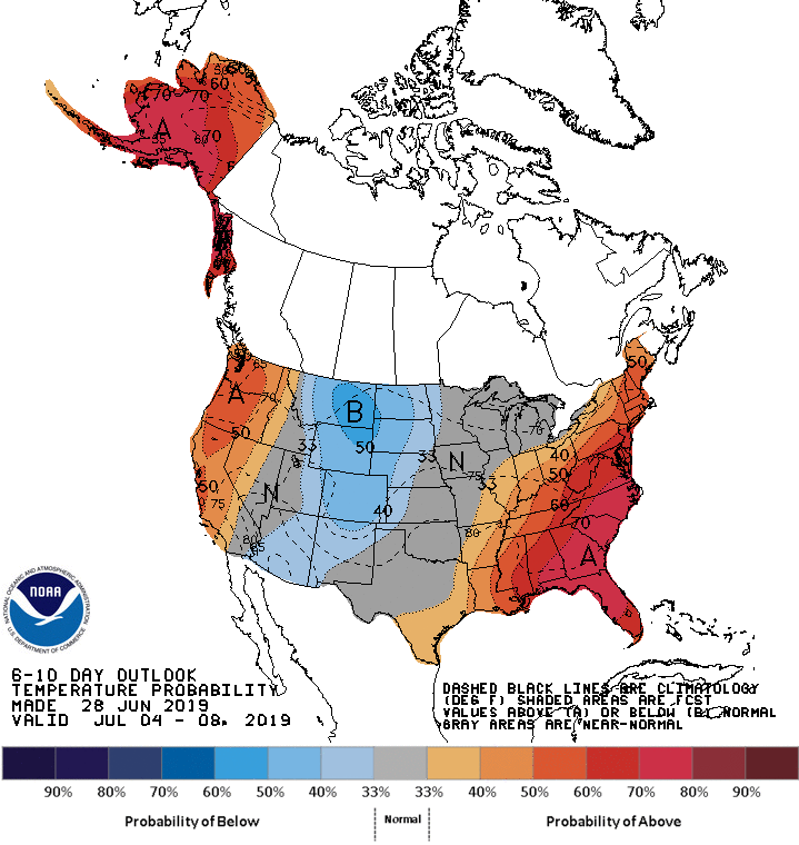
As head into the holiday week, we’re going to find an increase in ridging over the eastern half of the country once again. This will bring about above-average temperatures, which means that typical summertime heat is replaced by more of an intense heatwave with dangerous daytime highs and uncomfortably warm nighttime lows. We can see this reflected in the latest 6-10 day outlook from the Climate Prediction Center; showing the probability of above-average temperatures at about 60-70% in the Carolinas:
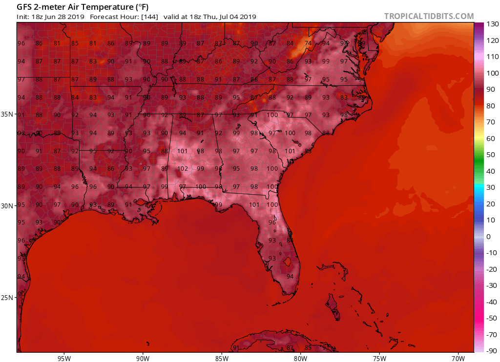
We’ll start the week fairly hot with a lot of 80’s and 90’s for daytime highs, but as we progress into Tuesday and beyond we will see high temperatures soaring well into the 90’s and approaching, if not exceeding the 100 mark for some locations. Heat indices will certainly make a run for at, or above 100 degrees for many locations. Check out the current daytime highs from the GFS model for the fourth:
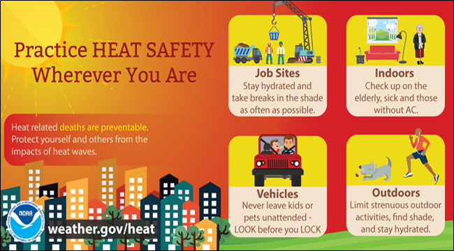
The European (not able to be shown for legality reasons) is considerably warmer. Regardless of which model is more exact, this heat could prove to be rather hazardous to your safety if you remain outdoors for an extended period of time, especially in consideration of the fact that many may be participating in activities surrounding the Independence holiday. The National Weather Service offers some safety advice for the event of a heatwave such as the one coming next week:
However, with ridging remaining fairly weak, this will allow some disturbances to dive in from the northwest and bring occasional scattered showers and thunderstorms to the Mid-South, including the Carolinas. The Climate Prediction Center alludes to the slight potential of a more unsettled pattern for at least North Carolina in their extended precipitation probability outlook:

This kind of setup comes with pros and cons. Heavier cells can bring about downpours. These can offer a temporary relief from the heat, but can also increase humidity, making the air feel more oppressive. When we focus on Independence Thursday, we find that modeling overall suggests a mainly dry start to the day, followed by showers and thunderstorms being scattered around in the afternoon, and increasing in coverage heading into the evening and nighttime hours during prime time for fireworks displays. Take a look at the latest GFS precipitation loop for the fourth:

Now don’t take this as exact, as shower and thunderstorm placement and intensity will fluctuate in later model runs. Just be aware that your outdoor holiday activities could be interrupted by this unsettled pattern. Another factor to be aware of is that sometimes excessive heat and unsettled weather tends to breed our more intense thunderstorms that can carry dangerous lightning, hail, and damaging winds. While no severe weather outbreak is anticipated at this time, it would be a good idea to keep abreast of the latest forecasts as we head into next week; especially on the fourth. Hopefully, we will see a drier trend in the forecast over time as we get closer, but there’s simply no guarantee of that.
This would be a great time to have our East Coast Weather Authority Mobile App. It’s a free download, and offers access to your latest local forecast conditions, as well as new articles and social media updates! Currently, our app is only available for Android platforms, but we hope to eventually have the app available to IOS users. https://carolinawxauthority.com/mobile-app/
-Jesse
East Coast Weather Authority
You must be logged in to post a comment.