
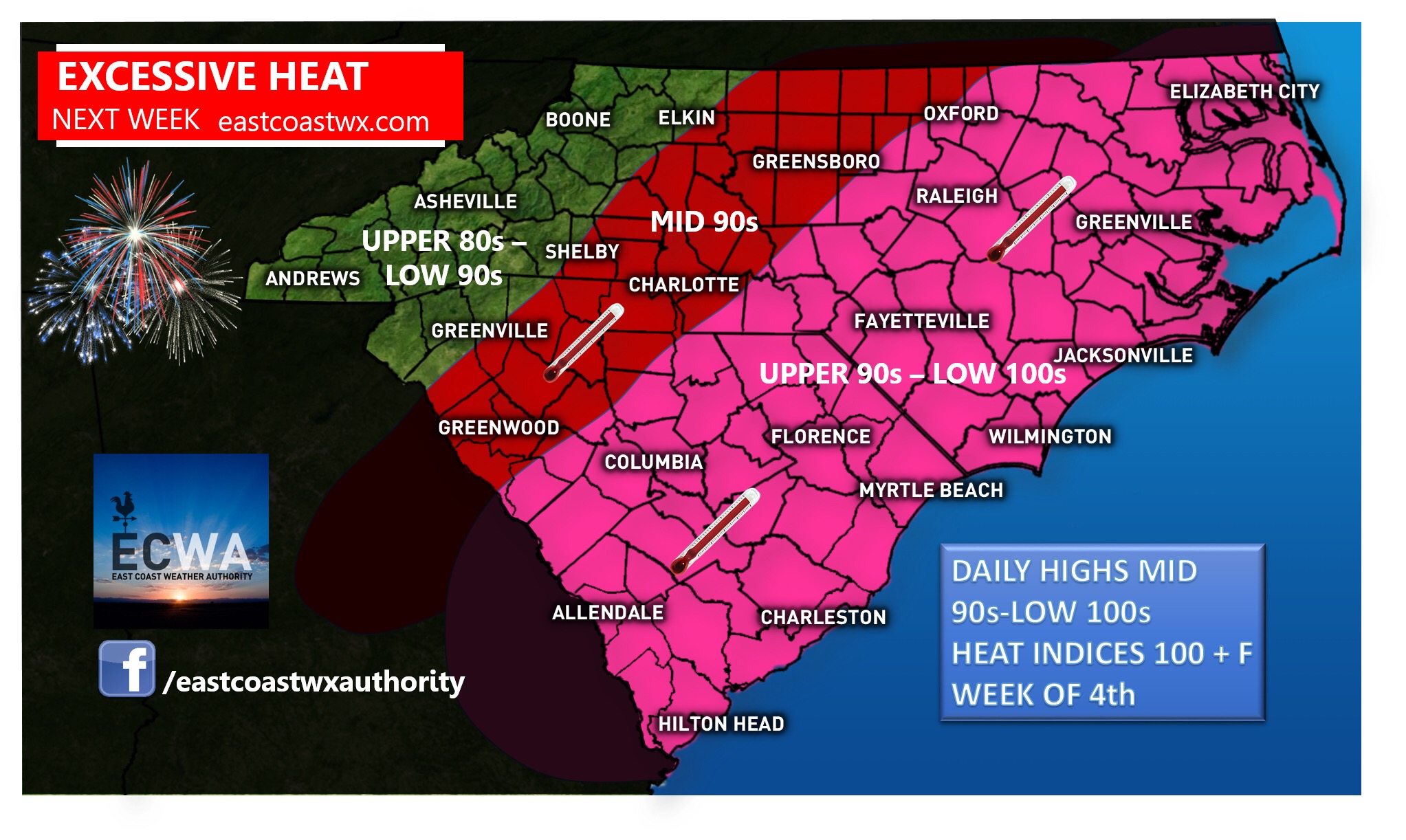
An intense heatwave is on the way for next week with our hottest days coming midweek. Many areas by midweek west of I-85 will be in the mid to upper 90’s with the only exception possibly being in the higher elevations where temperatures in the 80’s to maybe a few localized areas reaching 90 can be expected. A few areas in the western part of our forecast area may reach near 100 degrees in the lower terrain, and areas east of I-85 will likely see temperatures in the upper 90’s to low 100’s with heat indices even higher. Make sure to stay hydrated and pace yourself in this excessive heat, especially while participating in outdoor activities related to our upcoming holiday.
If you haven’t downloaded our mobile app, make sure to go visit the play store for your free download today. The app is only for Android at this time, but we hope to expand to IOS users in the near future. Get the latest articles on this upcoming heatwave and any potential severe weather events, as well as your current local information and other great stuff. https://carolinawxauthority.com/mobile-app/
-Jesse
East Coast Weather Authority