
It’s no surprise that temperatures will reach the 90s this week, as Henri will pull away and allow for high pressure to return. This means an upper-ridge and we all know what that means. It’s going to dry up, and we will get hotter.
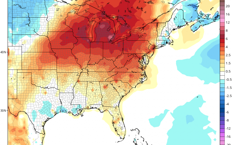
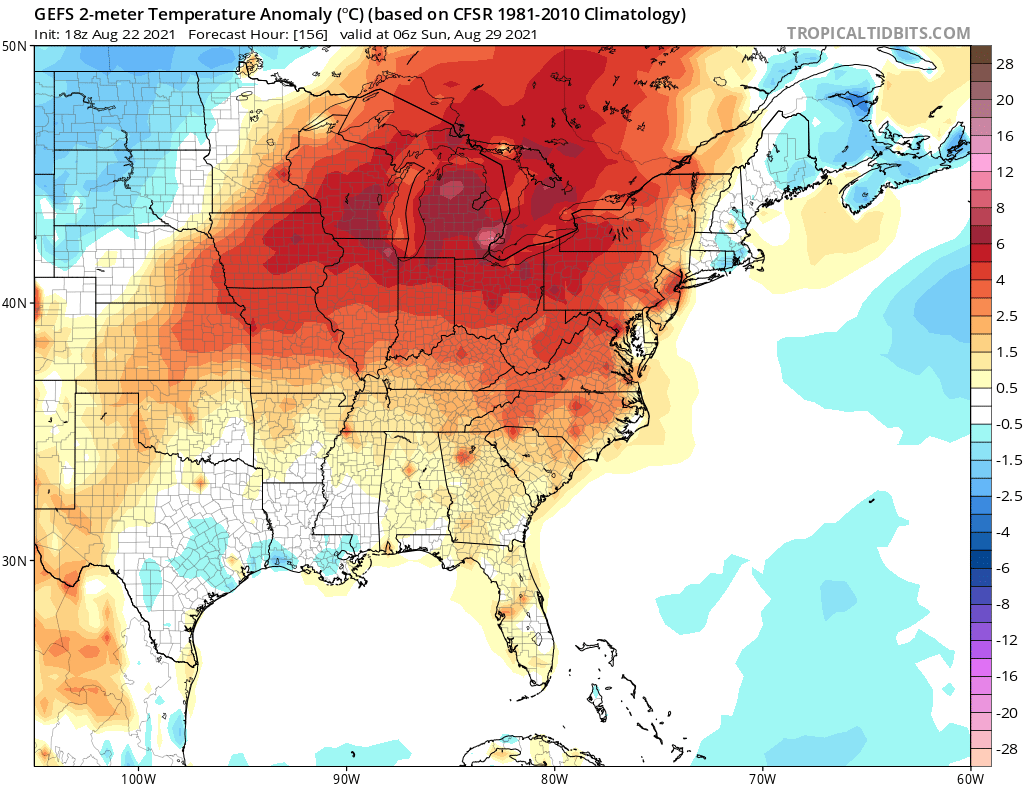
In fact this week some locations may reach the mid 90s across the Piedmont. Below are the overall temperatures anomalies for Aug 28th. This pattern does look to hold into early September, with above-normal highs. This is not completely uncommon for this time of year, in fact, it is “seasonal.”
Some projected high temperatures for Saturday, looking toasty across the Carolinas, but again, it is seasonal heat. These could be some good days or evenings to see a movie in the A/C (of course follow all covid procedures).

Nothing much else in the tropics to worry about this week. We will say the “Q” word, which is Quiet for now. Have a great start to a new week! Please share!
You must be logged in to post a comment.