If you like a cold and spooky Halloween, this may be the year for you. Looking ahead into the long-range, we see signs of overall below normal temperatures from the last week of October into early November.
Storm Tracker Sacher with the latest:
Shown here is ensemble mean from both the GEFS and EPS for a 5 day period around just prior to Halloween into early November .
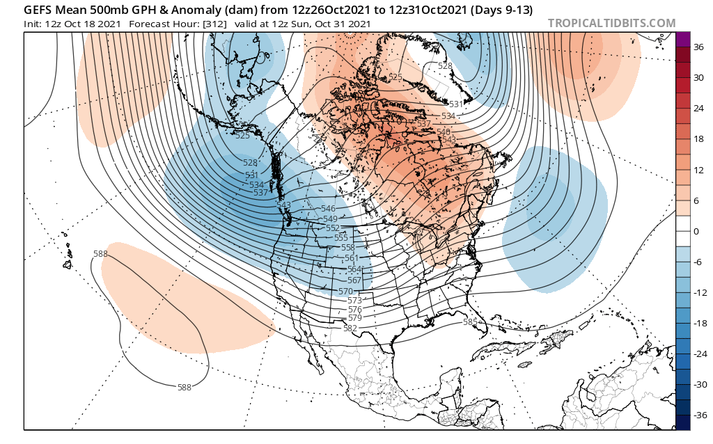
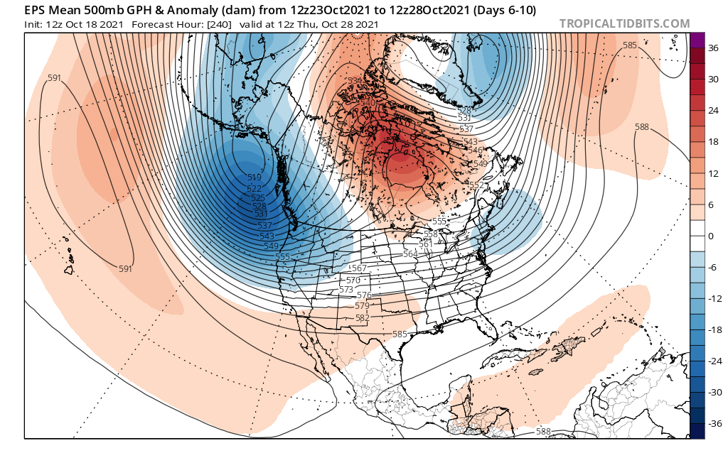
Displaying the 5 day means doesn’t show excessive lower heights, but you can see the jet undercutting as high latitude blocking develops. There is still some uncertainty and lower confidence in exact evolution and potential variability here, but I would expect the period from October 30th through November 10th to average below normal overall in temps with the potential for a couple of storm systems. During this time of year it’s not unheard of to see snow in the Appalachians and I could see that potentially happening during this period as well. Confidence on this forecast is a little lower than medium at this time.
Atlantic teleconnections look to be going negative. This would support the jet stream cutting underneath the blocking with more eastern troughiness.
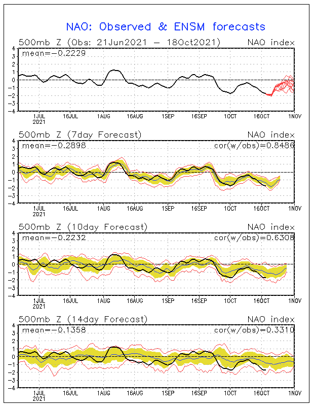
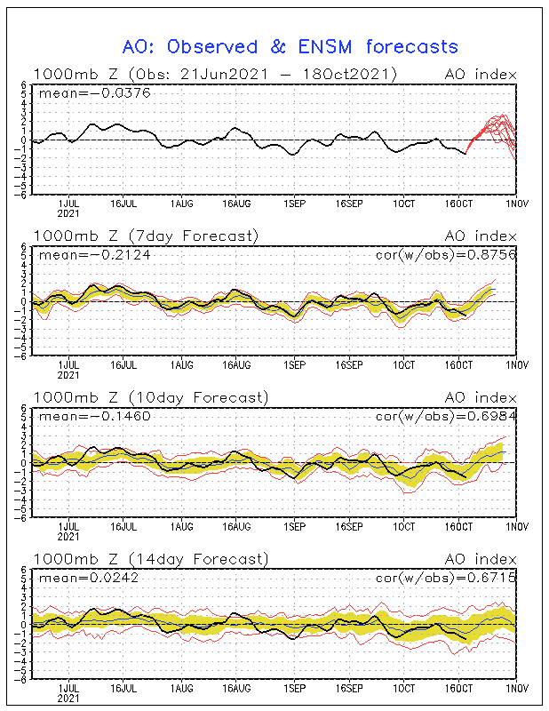
With the AO and NAO above trending negative, this signals East Coast cold, or at least below normal temperatures into early November.
What does this imply? Cold and possibly frozen precipitation for the higher elevations. And stormy overall, even if it is a cold rain, which is more often than not the case here in the Carolinas.
If you like cold and stormy, then the upcoming pattern at the end of the month is for you. We’re not sure what this means for winter, but it *could* mean an early start. Again, confidence in this upcoming forecast is less than medium.

You must be logged in to post a comment.