
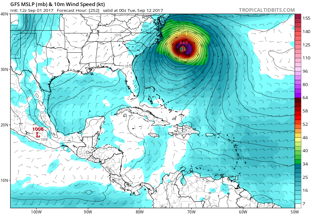
As of now, the GFS has Irma closely brushing the East Coast somewhere, namely the Outer Banks. This would only be an issue with waves and some wind and rain, however this model keeps Irma offshore. Unfortunately, she would continue to move north, however hurricanes rarely do that, so it would more than likely be a right turn out to sea.
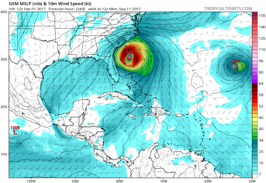
What about the Canadian, or CMC model? Not so forgiving. This model as a Southeast US impact somewhere near the Carolinas. This would be very similar to Hugo, and would be about as strong. Not something that we want at all here at East Coast Weather.
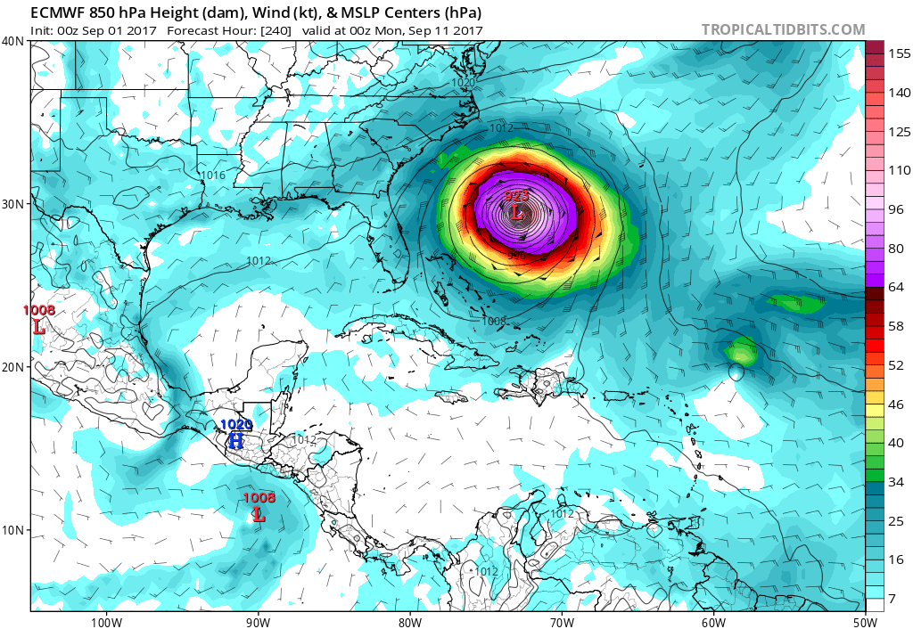
What about the king Euro? The Euro now tracks Irma near the Southeast US, but is hinting at a right-turn out to sea. This would be in some agreement with the GFS. The trend is your friend, and the trend for this storm with the Euro is now more north and east than it was yesterday. This is good news. Let’s hope this trend continues!
Become a premium member to receive emails and gain access to a members suite here on the site! Click here to sign up
You must be logged in to post a comment.