
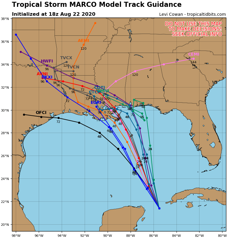
We do currently have Tropical Storms Marco and Laura, and they will wreak havoc in the Gulf. Marco had been expected to track more towards Texas but weakening as a tropical storm. However, recent models running new data from hurricane hunter aircraft show that Marco could reach the Louisiana coast Monday afternoon as a hurricane before the potential turn to the left. Intensity could be as high as Category 2. Hurricane watches are up now for the central Gulf coast, including New Orleans.
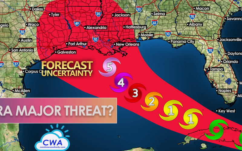
Laura has our attention, and could be a cause for concern. Laura will move over Cuba as a tropical storm but will then move over the open waters of the Gulf of Mexico. Once this occurs, rapid intensification is possible. The Gulf waters are very warm and hurricanes feed off of warm water. There will be little in the way of wind shear at upper levels in the atmosphere to hamper the strengthening of Laura. Currently, the NHC is forecast Laura to either be a Category 1 or Category 2 hurricane at landfall, but not a major Category 3 hurricane. This could be conservative at this point in time.

We at CWA think this storm could be a lot stronger wherever she decides to make landfall. The cone of uncertainty extends from Texas to Mississippi, so she could strike anywhere in between. This could mean another Katrina for New Orleans if she took the exact right path. But we do not want to see that.

At some point next week, residents in the red cone need to think about and possibly take action should any evacuation orders be given. To pinpoint the exact location at this point is impossible, all we can say is that anyone in the cone should be alert.
Hurricanes have the potential to rapidly intensify in the Gulf over warm waters, as did Michael in 2018. At least one of these could.
-CWA
You must be logged in to post a comment.