
Sinking air across the Atlantic basin couldn’t stop tropical storms like Josephine and Kyle from forming over the past five days, but conditions now appear ripe for a hyperactive period of tropical storms and hurricanes in the Atlantic Basin over the next few weeks. We expect no fewer than four named storms (Laura, Marco, Nana, Omar) to develop between now and the end of August, and at least one or two could threaten the United States as a major hurricane before Labor Day!
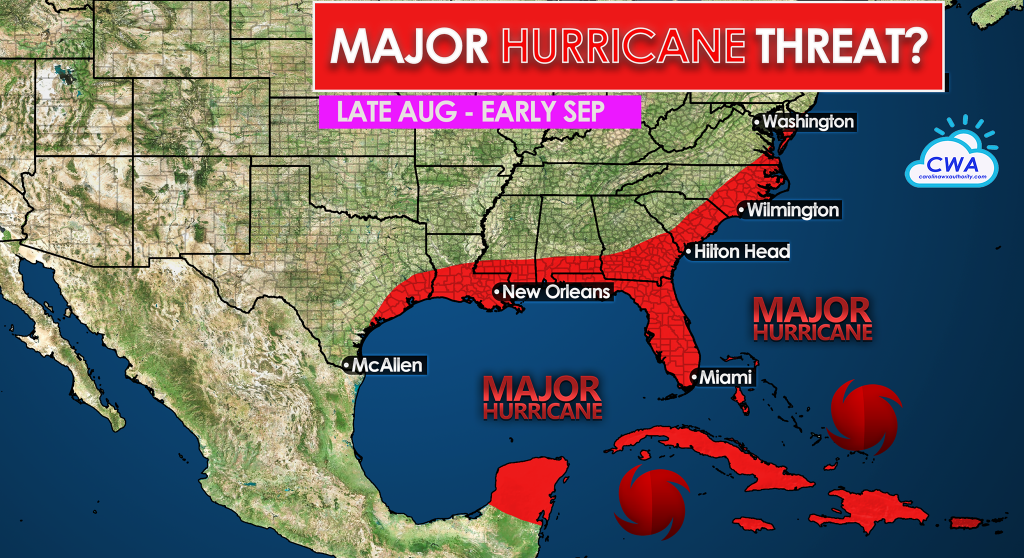
Climatologically, the most active period for hurricanes is late August through early October. We have a La Nina watch for cooling Pacific Ocean waters which favors rising air and tropical development in the Atlantic basin. In addition, ocean water temperatures remain above average and favor, under the right conditions, rapid intensification of storms on either side of Florida, over the Gulf, and over the northwestern Caribbean. In addition, an expected favorable phase of the Madden-Julian Oscillation will help weaken wind shear and allow for dry air surrounding the Cape Verde wave train to gradually moisten.
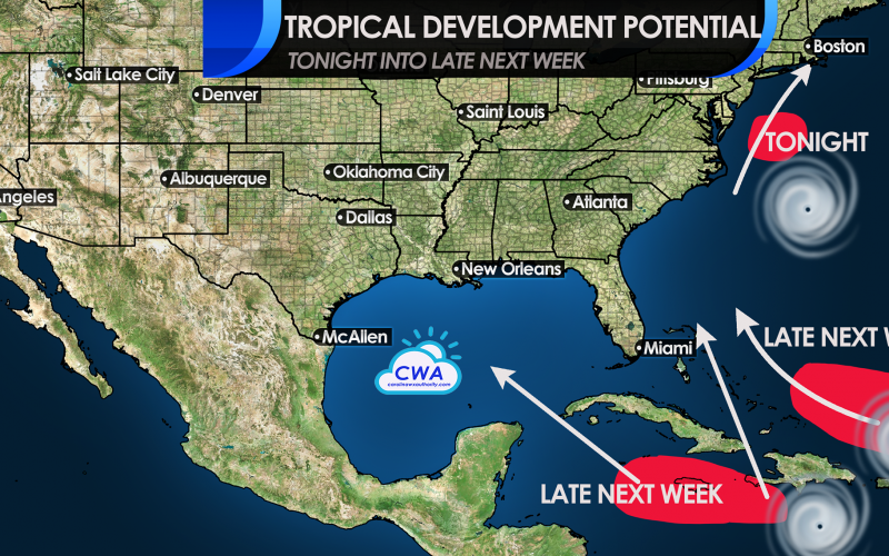
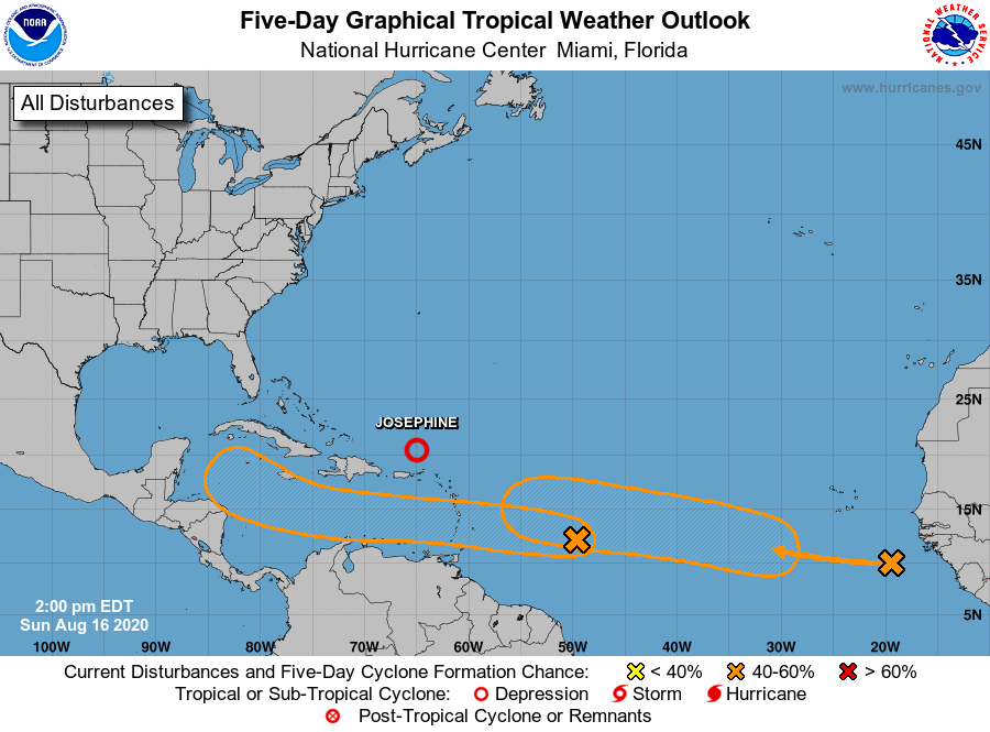
While Kyle has weakened and merged with a front over the northern Atlantic, and Josephine is soon expected to degenerate into a tropical wave between Puerto Rico and Bermuda, we have four areas to keep an eye on right now. Low pressure off the Delmarva will track northeast and clip coastal southeast New England overnight with tropical storm force wind and rain, but ocean water temperatures are only marginal for tropical development. Thus it’s a long shot, but another “Kyle” could briefly try to form in the next 24 hours, following a track a little farther north.
Two tropical waves which came off of Africa over the past 3-5 days show signs of gradual development in the next 3-5 days. Both of these look to position themselves into places where they can develop into hurricanes, and threaten land.
Since the Atlantic high is shifting farther south than it has been all month, the Gulf of Mexico looks likelier than the Eastern Seaboard for the first wave, which is set to enter the Caribbean Sea by Tuesday. It is not out of the question that the wave stays far enough south to avoid the U.S. entirely, but it’s equally as likely to turn northeast and affect Georgia and the Carolinas after a potential Gulf impact. The next wave just left the African coast and could track into the Caribbean and either looks to follow the first wave, or emerge north of Hispaniola and threaten Florida to the Carolinas. Both waves could become major hurricanes at some point, though it’s obviously way too soon to say when and where.
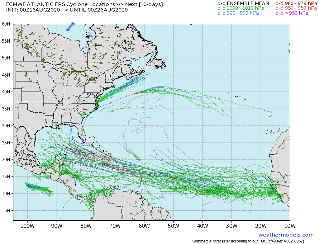
And finally, another large wave over central Africa will emerge into the Atlantic towards Friday and Saturday and bears watching as it could eventually be a problem for the U.S. towards Labor Day. It could also find a way to recurve east of the Atlantic Seaboard.
We have a video with much more on these systems on our YouTube channel. We encourage you to spend ten minutes to watch it, and subscribe and invite others to subscribe to our YouTube channel for the latest. Now is the time to ensure you are prepared for a hurricane.
You must be logged in to post a comment.