
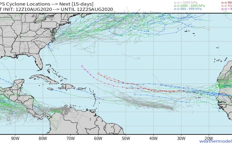
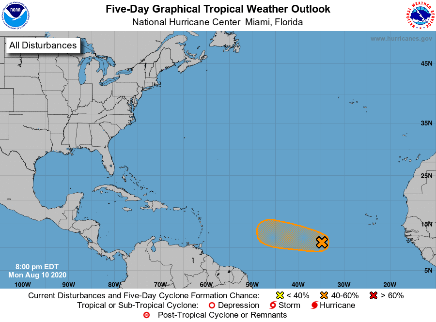
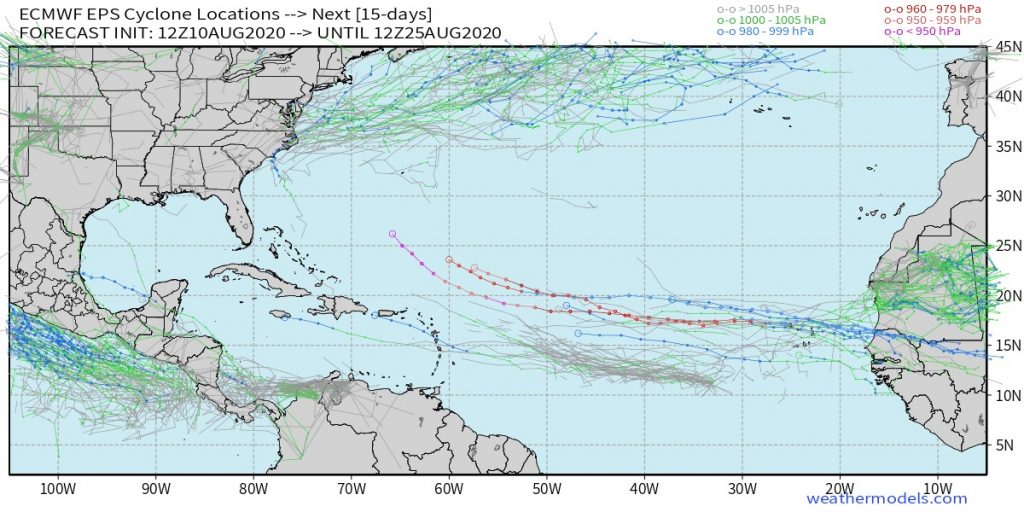
Conditions in the Atlantic aren’t currently favorable for hurricane development, but we do have three features in the eastern Atlantic that catch our eye. The first is being watched for tropical development as a wave near longitude 36 degrees west shows some disorganized pulses of thunderstorms. Models have been run on this disturbance (95L) and show some slow development, but a hostile environment for a long tracked system as it crosses the central and then southwest Atlantic late this week into the weekend.
A second tropical wave behind this one at 20 degrees west longitude has similar chances for development down the road, but it is likely to struggle as well. Neither of these waves is large, and the vast area of dry, sinking air to their north typically creates a hostile environment for any long term success over the length of the Atlantic Ocean.
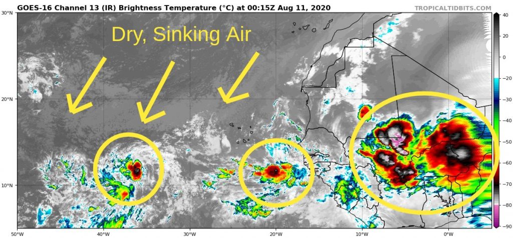
But a third area of thunderstorms near the Prime Meridian with much more juice to it could be a bigger deal down the road, as it is set to emerge off the African coast during the middle to second half of the week.
It’s obviously way to soon to make any projections as to what might happen with this wave, but we at CWA see signals for more favorable environment for development coming 10 days down the pipe, as the sinking air over the Atlantic Basin is phased out by a transition to much more rising motion across the tropics. It may take some time to get this wave to develop, but the odds are ever in its favor for a longer tracked storm.
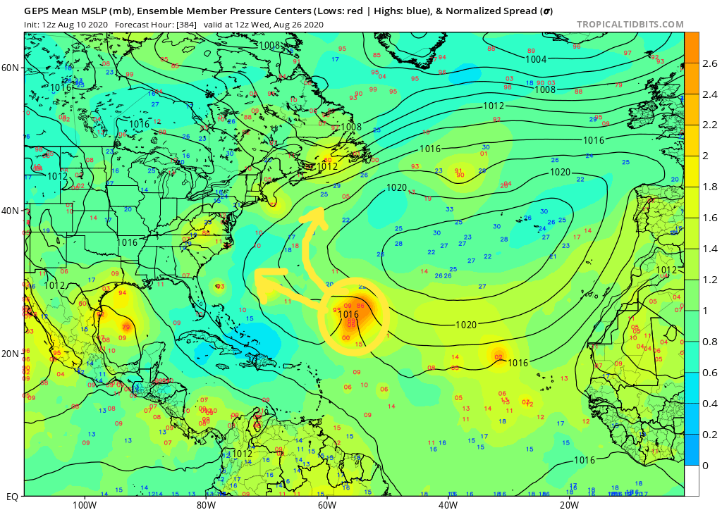
The European Ensemble suite is latching on to this system kind of like it did with Isaias more than 10 days before that hurricane was even named, and with the shift to a more active phase, we believe this is something to watch. Some solutions even point to this disturbance becoming a Category 3 or stronger hurricane. While that’s not an official forecast so far out, it is more of a possibility than anything we’ve seen at this point in 2020. So without sounding the hype alarm, let’s just say we need to keep an eye on it for now. A potential impact to the East Coast at the end of August or first couple of days of September is equally as possible as a recurving storm that only threatens Bermuda or maritime interests.
Please visit our YouTube channel for more in-depth analysis, including our latest video.
Keep it tuned here to CWA for the latest as we have a lot of time to watch the tropics this month. The next three storms on the list are much easier to pronounce: Josephine, Kyle, and Laura.
You must be logged in to post a comment.