
We have two tropical disturbances in the Atlantic basin that have a high chance to develop into named storms Laura and Marco by the end of this week or early this weekend. The disturbance closer to the U.S. may take longer to develop than the one farther out in the Central Atlantic, so Marco could affect the U.S. before Laura does next week, if forecast tracks hold.
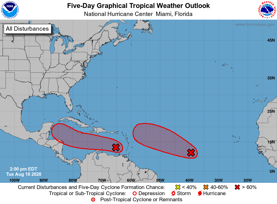
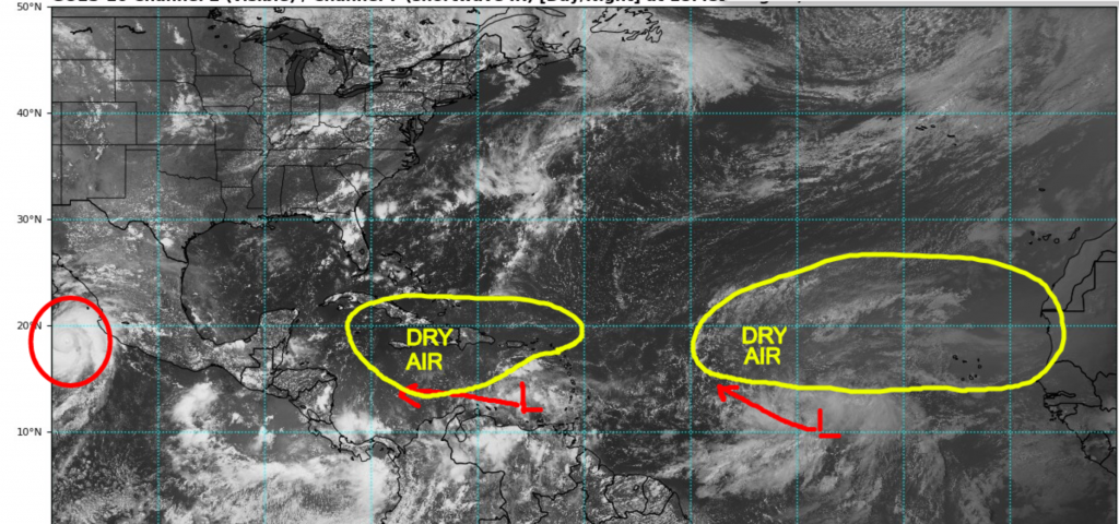
Conditions in the Tropical Atlantic are quickly becoming more favorable for storms to not only form, but to intensify into hurricanes. Current conditions are not ideal for rapid intensification as dry air covers two-thirds of the Atlantic, but a gradual moistening and lessening of wind shear is expected to take shape as these disturbances move westward into warmer waters with a lot more available oceanic heat content.
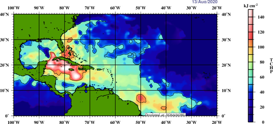
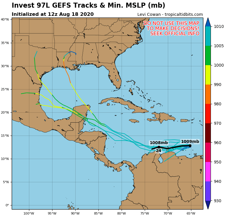
The forecast track of the first disturbance takes it into the western Caribbean over the weekend, then there will be a chance for the storm to slow down, intensify, and potentially make a right turn. A trough extending into the central Gulf states will act as a magnet to draw the system northward, and at this point, it is likely to be Tropical Storm Marco. Most models keep the system from reaching hurricane intensity, but there is a window for intensification early next week if the storm can spend enough time over warm water. A map below shows the oceanic heat content is high over the northwestern Caribbean and the southern Gulf of Mexico.
Forecast guidance remains uncertain on the potential track and intensity of future Marco, but some solutions threaten Texas and Louisiana in 7-8 days if it can get far enough north of Honduras and come up near the Yucatan. There’s equally a chance the system remains weaker and sheared and stays south of Texas. It will likely be a few more days before the track is more agreeable.
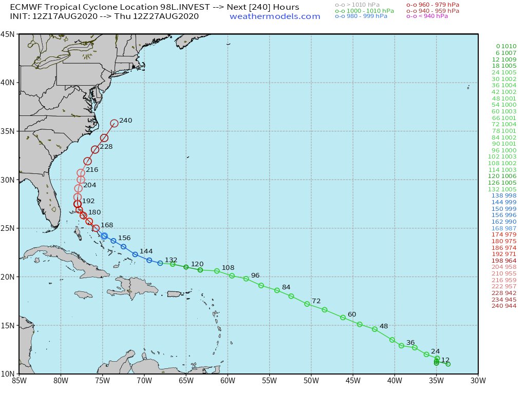
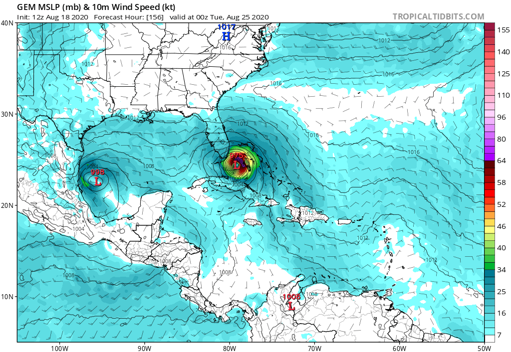
Of greater concern is the system behind future Marco which will likely get a name before him, and Laura is the next name on the list. This system has a larger area of thunderstorms and will track into a more favorable environment for development during the late part of this week and this weekend. Models do agree mostly that the system will strengthen and will cross near or to the north of the NE Caribbean island nations. After that, the strength of the high pressure ridge to her northeast will determine if the storm makes a right turn. Models are keying in on a track near Florida, with potential for this to be our first major hurricane (if Marco somehow doesn’t get there first). However, the shape of the Southeast Coast leaves a lot of locations in the window to be aware. Some solutions have a hurricane continuing across the Gulf towards Texas, others have a storm that cuts through or just west of Florida, and even others show a storm coming up towards or just offshore the Carolinas.
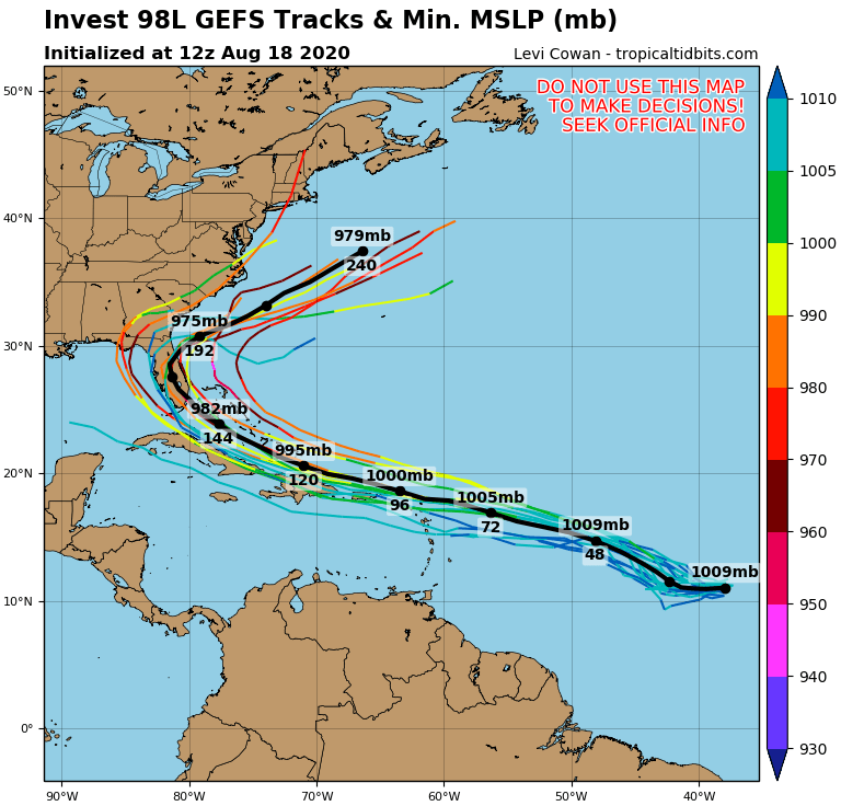
It’s possible both systems could affect Florida and the Carolinas if 1. the trough is stronger than currently forecast, or 2. it isn’t, but the remains of Marco get pushed east across the Deep South. And the last thing we really need right now is a lot more rain.
Of course, it is way too soon to make a call on either one of these. The European model has struggled to be consistent, while the Canadian and ICON models show more consistency and a threat to Florida and the Gulf Coast. But we don’t know if any of them will really nail down the forecast for several more days. See what we’re talking about?
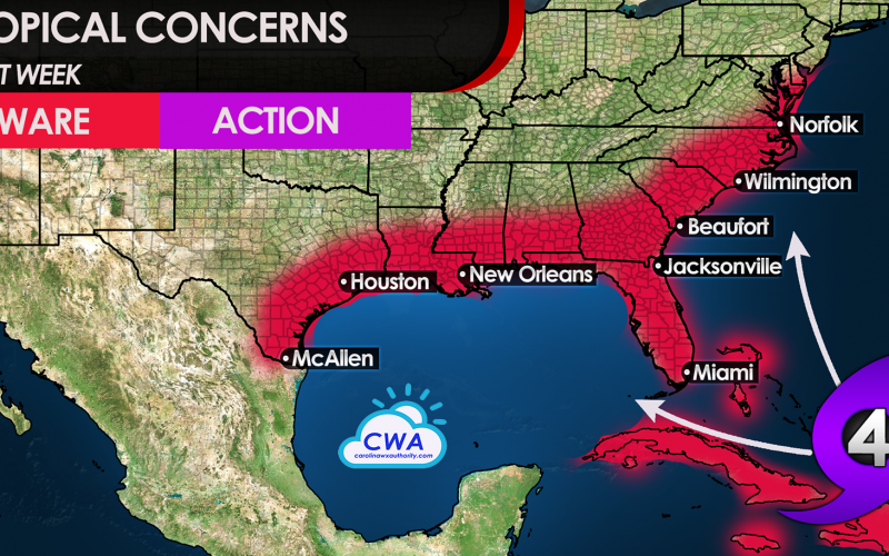
At this time, we recommend you remain aware and watch closely. It’s too soon to take any action, but it’s always a good plan to have a plan in the event that a hurricane could impact you. The models will change several times between now and the weekend, which is why the National Hurricane Center has a cone of uncertainty that grows with respect to time. We are at the beginning of an expected 2 month stretch of hyperactive tropical activity, and just because some may have already been affected by a storm doesn’t mean another couldn’t strike the same spot.
We have a video posted last night with much more on these systems on our YouTube channel. We encourage you to spend twelve minutes to watch it, and subscribe and invite others to subscribe to our YouTube channel for the latest.
You must be logged in to post a comment.