
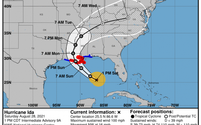
Preparations should now be complete across southern LA for major hurricane Ida. Currently Ida has sustained winds of 85 mph in the Gulf which puts it at Cat1 status. NOAA Hurricane Hunter reconnaissance aircraft are going in tonight, so we will have some better data by tomorrow (Sunday) morning.
Ida is expected to make landfall around 7pm Sunday as a Major Category 4 very dangerous hurricane. She will then slowly move northeastward into TN, perhaps bringing some rotating thunderstorms that could touch off tornadoes. We may get some after-effects here in the Carolinas, however the track confidence is very low into the middle of next week.
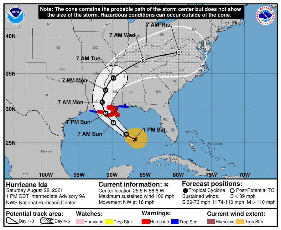
Below are the forecast winds and position for Ida up to and after landfall:
FORECAST POSITIONS AND MAX WINDS

INIT  28/1500Z 24.8N  86.1W   75 KT  85 MPH
 12H  29/0000Z 26.3N  87.9W  100 KT 115 MPH
 24H  29/1200Z 28.0N  89.8W  115 KT 130 MPH
 36H  30/0000Z 29.4N  91.0W  115 KT 130 MPH...INLAND
 48H  30/1200Z 31.0N  91.5W   60 KT  70 MPH...INLAND
Official discussion here: https://www.nhc.noaa.gov/text/refresh/MIATCDAT4+shtml/281457.shtml?
This is a very dangerous hurricane and all residents in southern LA and New Orleans should heed this forecast and evacuate if you have not done so already. The time has come. Get out now! Do not further wait for interstate gridlocks. The window of opportunity for getting out is closing.
Again, a bit too early to tell if severe storm impacts here in the Carolinas next week, but our northern area could get clipped. Stay tuned!
You must be logged in to post a comment.