
Michael unleashed his fury over Florida Wednesday. Catastrophic damage is expected from Panama City beach area and to near Tallahassee. Tornadoes, wind damage, and flooding are expected well inland.
Michael is a fast moving storm, so he will maintain his strength over land, which is not good for inland areas especially across the Carolinas and Virginia. Impacts will be felt into these areas.
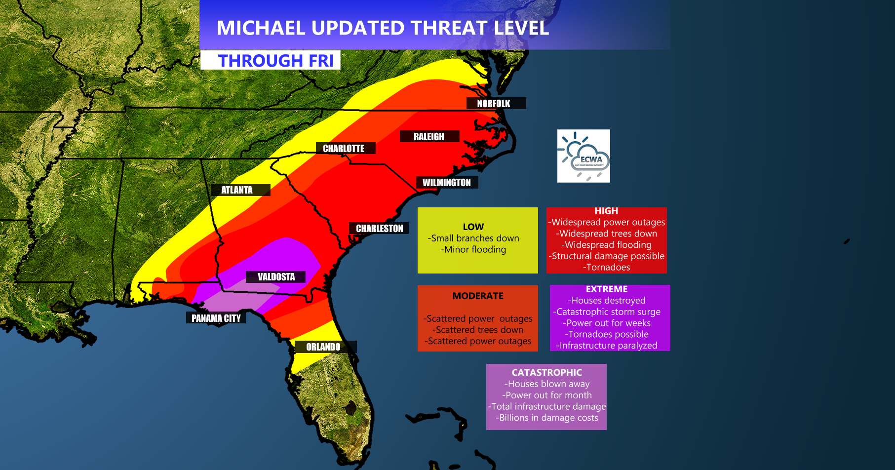
Details for each threat outline are in the image. This storm will be offshore by the weekend so everything will unfold rather quickly. Pay attention to your local media outlet and consult your local NWS office for official information.
A big issue for the eastern Carolinas could be a tornado outbreak. Residents should not let their guard down and should expect tornado warnings to be issued. Have a plan!
Many trees down, power outages, flooding, and structural damage are expected before this whole event is said and done. Once the wind picks up, it is NOT safe to be outside. Travel between now and Friday is NOT recommended. Trucking companies and those who are using moving trucks should take special note of this.
Meteorologist Mike Griffith
East Coast Weather Authority
You must be logged in to post a comment.