
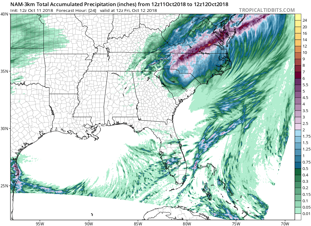
Michael has drastically weakened in strength over the past day, but tropical downpours for the Carolinas will continue into Friday. Many places that are seeing more rain saw record rains when Florence stalled out dumping over 3 feet. Michael is quick moving and won’t dump that much rain, but with already saturated grounds and tropical storm force gusts possible over the next 24 hours, power-outages and storm damage are possible.
The heaviest of rains will be falling from eastern North Carolina, through the Richmond region and into the Delmarva until Michael departs Friday morning.
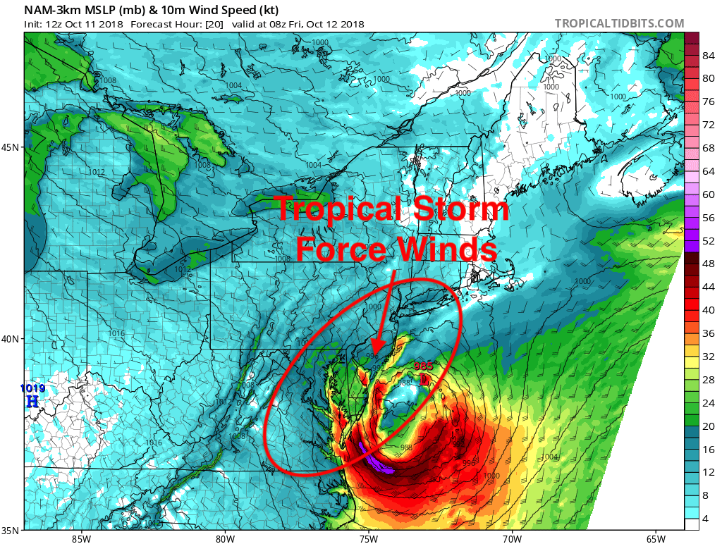
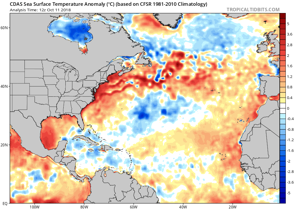
Another threat as Michael moves off the coast is that he may re-intensify as he will be moving over the very warm Gulf stream which will be more energy added to the storm. This will cause gale force winds for the coastal regions of the Delmarva.
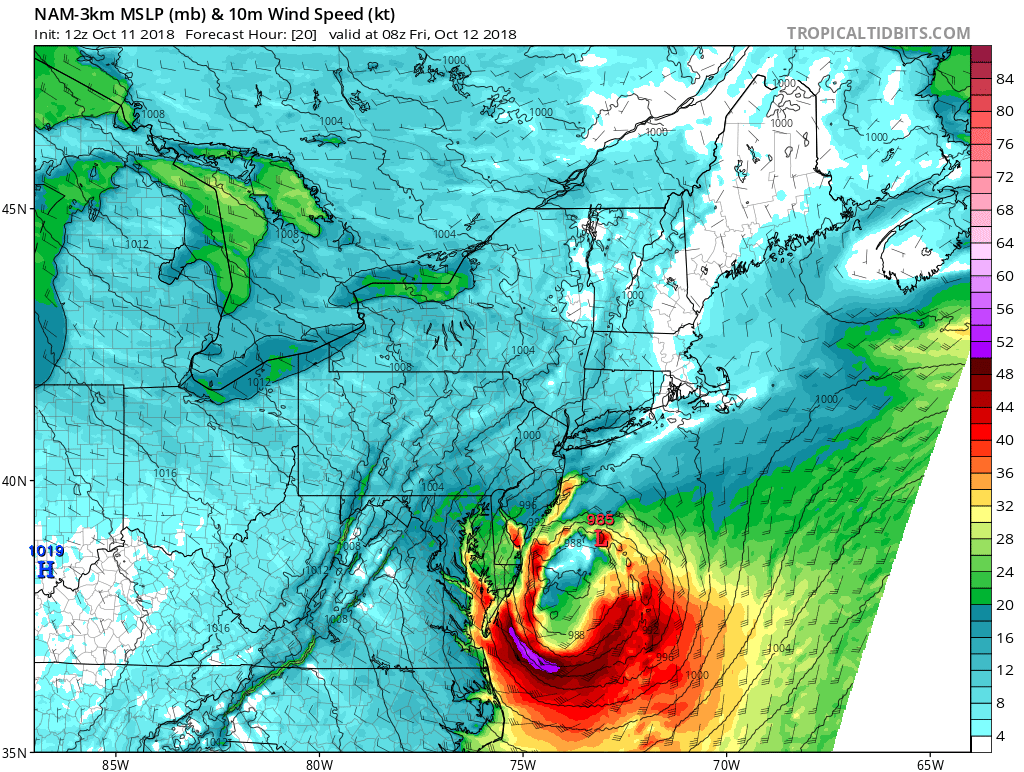
Conditions will deteriorate over the Northeast coast Friday morning as Michael moves off the coast and re-intensifies. Gale warnings are already in place from the national weather service for coastal areas from Delaware to Maine.
We will continue to update you as Michael moves off shore late tonight.
-Alex B
You must be logged in to post a comment.