
Hurricane Michael currently is in the gulf of mexico where it will be intensifying until it makes landfall in the panhandle of Florida. As the Hurricane makes landfall around mid day Wednesday it will be losing energy as it quickly moves along a northeast track towards the Carolinas.
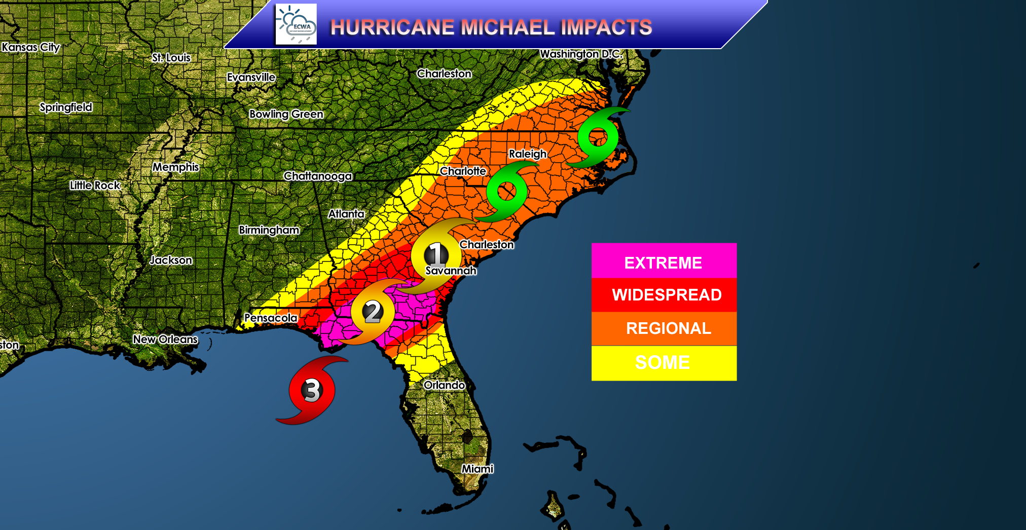
For those who live within this extreme area, expect life threatening conditions, such as severe flooding and strong, damaging winds reaching over 90mph. With winds this intense it is a guarantee that there will be trees down and power outages. The area shaded red for severe can expect moderate to severe flooding and again, strong winds around 70mph that will bring trees down and cause power outages. In the orange moderate region, the main concern is the winds, however some moderate flooding is still possible. Winds will be around 45mph, with some stronger gusts along with power outages and more trees down. In the yellow slight risk zone nothing too major will occur other than strong gusts of wind that can cause a few heavy branches to fall along with some rain.
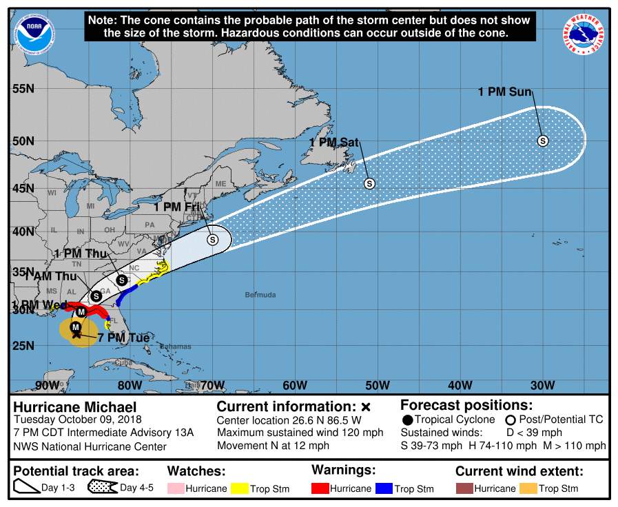
Finally, taking a quick look at the timing and exact track of the storm, Florida and Georgia should see rain and strong winds Wednesday morning which will persist until around mid day Thursday as the Hurricane moves quickly up the coast through the Carolionas and eventually out to sea by Friday morning. Please stay safe and listen to local officials and evacuate accordingly. Check back here at East Coast Weather Authority for your latest update on Hurricane Michael.
-Benjamin Charles
You must be logged in to post a comment.