
The heat is on even though the calendar says autumn. The next few days will be unseasonably hot, and next week some records could be broken. We are looking at some mid to upper 90s readings in the South! The GEFS shows some 97 degree highs for Charlotte. Parts of South Carolina could be around there or even higher! This is unprecedented for this time of year.
However, relief is on the way. The heat will break late next week as a powerful cold front moves in from the northwest. They are forecast to receive up to THREE FEET of snow in parts of Montana! This cold air will eventually make its way east, and by next weekend, we could be looking at lows in the 40s and 50s here in the South!
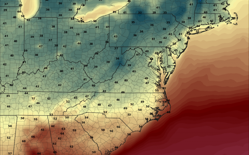
GFS valid for next Saturday October 5th at 8 am:
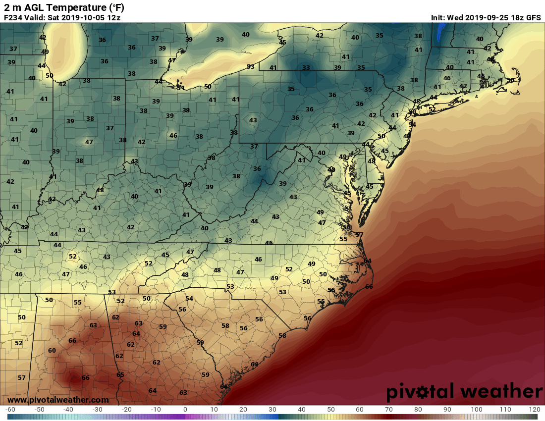
Latest indications are that daytime highs will NOT shoot back up into the 90s after this cool-down. Therefore, the fall-like air could be here to stay this time, however confidence is not 100% certain. But we are not seeing indications of another gigantic ridge of high pressure and mid 90s for daytime highs. However, daytime highs could rise back into the mid and even upper 80s.
GEFS ensembles are pointing towards no more extremely hot temperatures.
Fall arrives next week. Hopefully pic.twitter.com/OkfEVse1dU
— Jordan Tessler (@TerpWeather) October 10, 2017
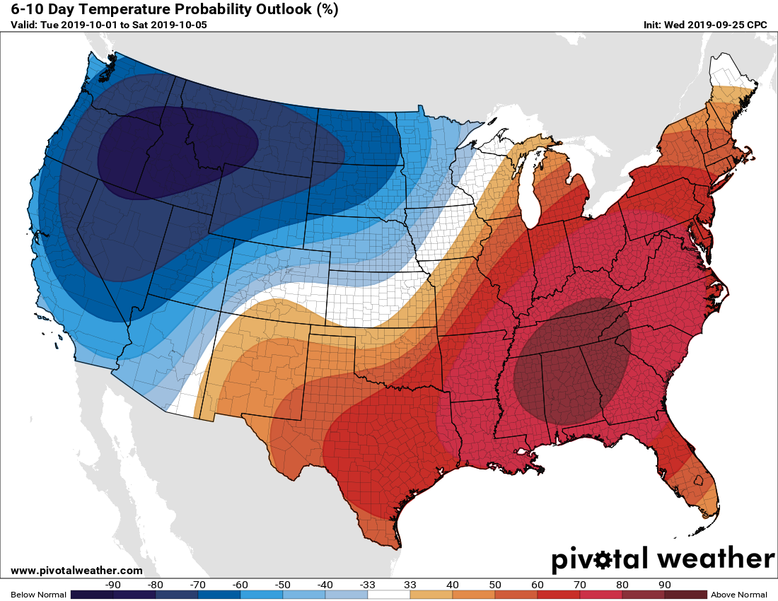
Up until next weekend, we can expect to bake and sweat here in the East. Some of the models may be overdone as far as EXTREME heat, however indications are that it will be hot. The only saving grace is the lower sun angle as we get later in the season, which could limit high temperatures. The NOAA CPC outlook from now until next weekend has a “blowtorch” over much of the East Coast.
You may get one more use out of your pool, if they are still open!
-CWA
You must be logged in to post a comment.