1-19-2016
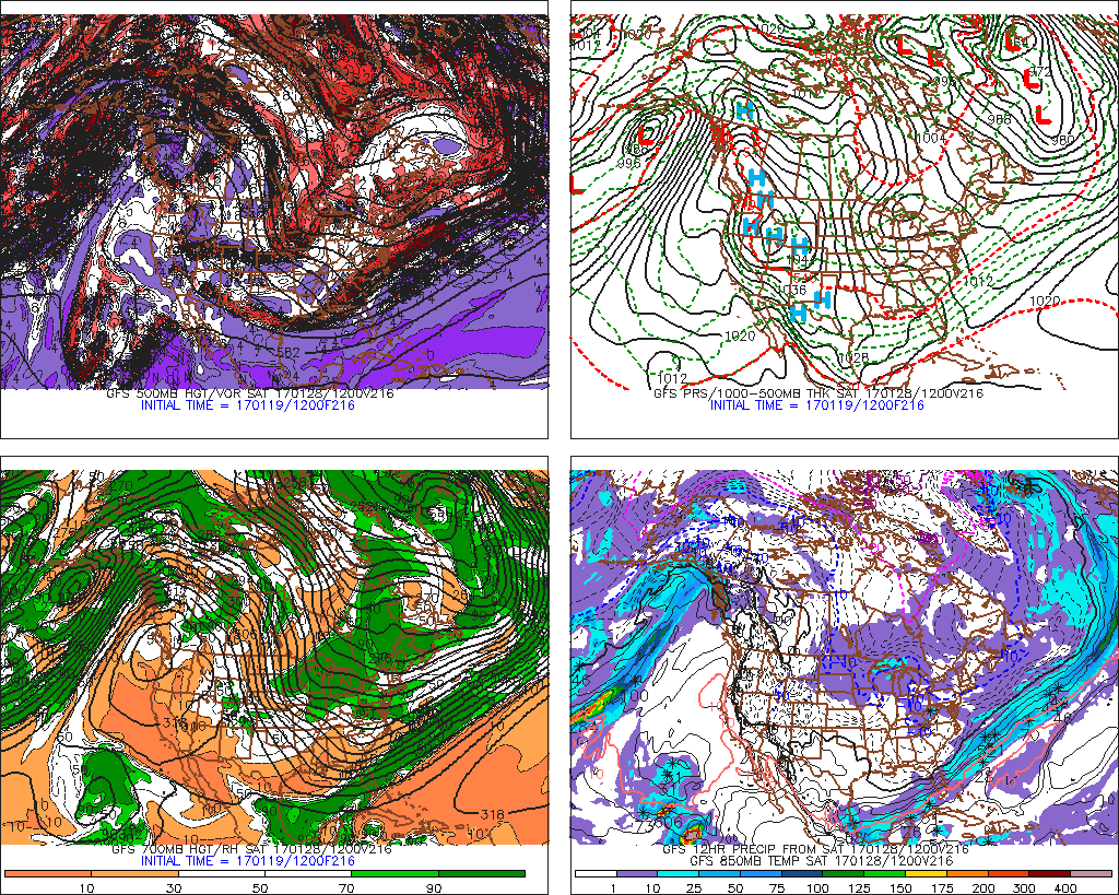
Heading into the late-month, anytime after the 26th, we are looking at an extreme cold shot. This cold air is expected to dip all the way into the Florida Panhandle. First image shown is January 28th. Look at the bottom right panel. Anything above that black line will be bitter cold.
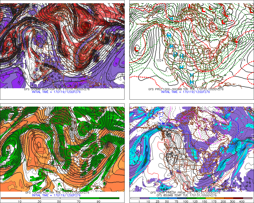
Looking ahead to the 31st (2nd image), the extreme cold remains dug in and a coastal low or two at some point is an increasing possibility! Multiple waves of upper-level energy start to dive into the East Coast on top of all the cold, and we know what that means! Sign up for memberships here
Questions? Comment below