
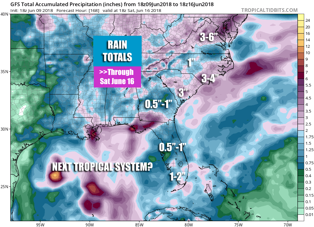
As if we didn’t have enough rain to deal with (which is good since we don’t want a drought), more is on the way. Sunday through Saturday rain totals are shown below by the GFS. We could be talking multiple inches of rain in locations that do not need more. As a result, more flooding will be likely in the coming weeks.
Not everyone will get wet at the same time, and not every location will receive steady rain, but the takeaway is that most people will see rain at some point in the coming week. The rain will be off and on in nature and some locations could receive downpours, causing flooding in poor drainage areas.
The GFS model has multiple rounds of showers and thunderstorms from Sunday through Saturday across much of the region. Notice there is also a tropical storm that could be headed into the Gulf. We will have more details on that over on the premium blog.

Images courtesy of www.tropicaltidbits.com
As the ground is saturated from recent rains, any additional rain will likely cause flooding issues. We may see more flooding in areas such as western NC where recent land and mudslides have occurred.
Past 14 days percent of normal for NC/SC:
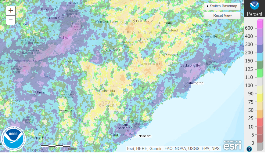
Many locations along the coast including Charleston and Wilmington have already had more than 100 percent of their normal rainfall.
Do not attempt to drive through flooded roads but rather turn around, as the water may be deeper than you think. Head over to our premium blog here on the site for more details.
-Mike G
Meteorologist
You must be logged in to post a comment.