
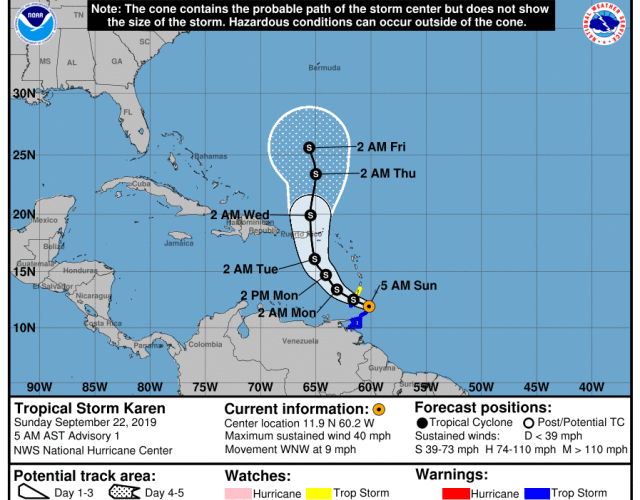
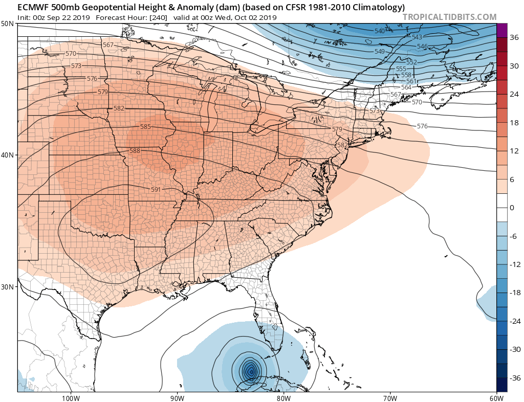
Tropical Storm Karen has formed in the south Caribbean overnight Saturday into Sunday, and this storm will move north across Puerto Rico early this week. While this storm is forecast to move due north, a strong ridge of blocking high pressure may send her on a more westward track over the next week or so. Since the heat will be building back in here in the East, this signifies a ridge of high pressure, which could block Karen from moving north.
This is a tad bit concerning especially if Karen heads on a more westward track, which would bring her closer to the US. It is still way too early to determine where Karen will go if she does in fact track more west.
Latest Euro spaghetti or ensemble tracks show a wide range of track possibilities, so we are by no means locked into any certainty just yet. However we will have to watch any tracks that are trending westward.

The latest run of the Euro deterministic model takes Karen just north of Cuba and into the Gulf. We certainly hope this does not verify. The upper-level ridge centered over the South Central US may help drive Karen into the Gulf and more due west. However, this track is uncertain at this time and it’s still too early to tell any exact details.
Stay tuned as tropical activity is expected to ramp up as we head into October. Make sure you follow along with our models page right here on the site!
-CWA
You must be logged in to post a comment.