
MORE BENEFICIAL RAIN ON THE WAY
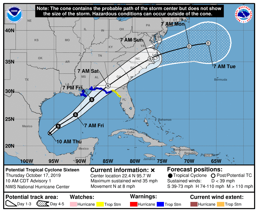
The recent rains have barely made a dent in our drought, however that dent could deepen this weekend as what could be Tropical Storm Nestor moves over our area. The NHC currently lists this storm as Potential Tropical Cyclone 16. What could be future Nestor will make landfall on the Florida Panhandle late Friday night into early Saturday morning. This will be a fast-moving storm, so it will approach Florida quickly. Then it makes a transition into an extra-tropical cyclone once over land.
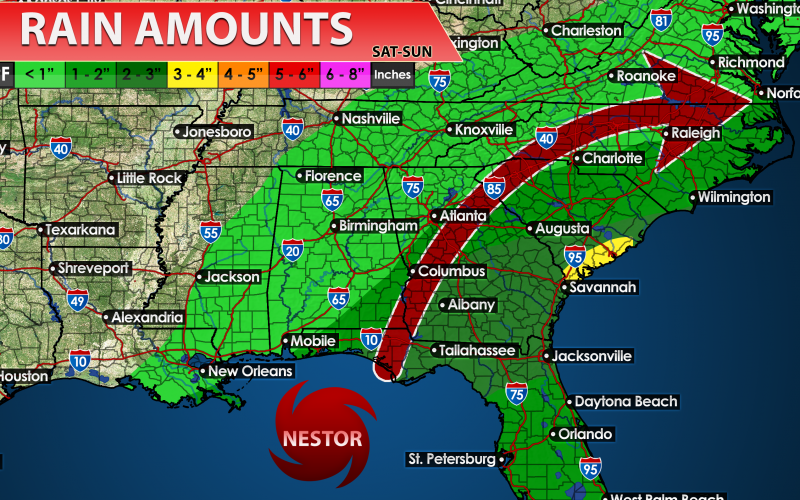
As we can expect here in the Carolinas, a steady rain will overspread the region along with some gusty winds depending on the exact track. The timing is late Saturday afternoon and into early Sunday. The rains are not expected to be flooding in nature as this system will be a fast mover. Heaviest rain can be expected across the SC Lowcountry. A soaking rain is expected across much of the central and eastern Carolinas. This storm will be gone from our area late Sunday and out to sea by Monday. We will dry up as a result, but could remain mild as opposed to cold.
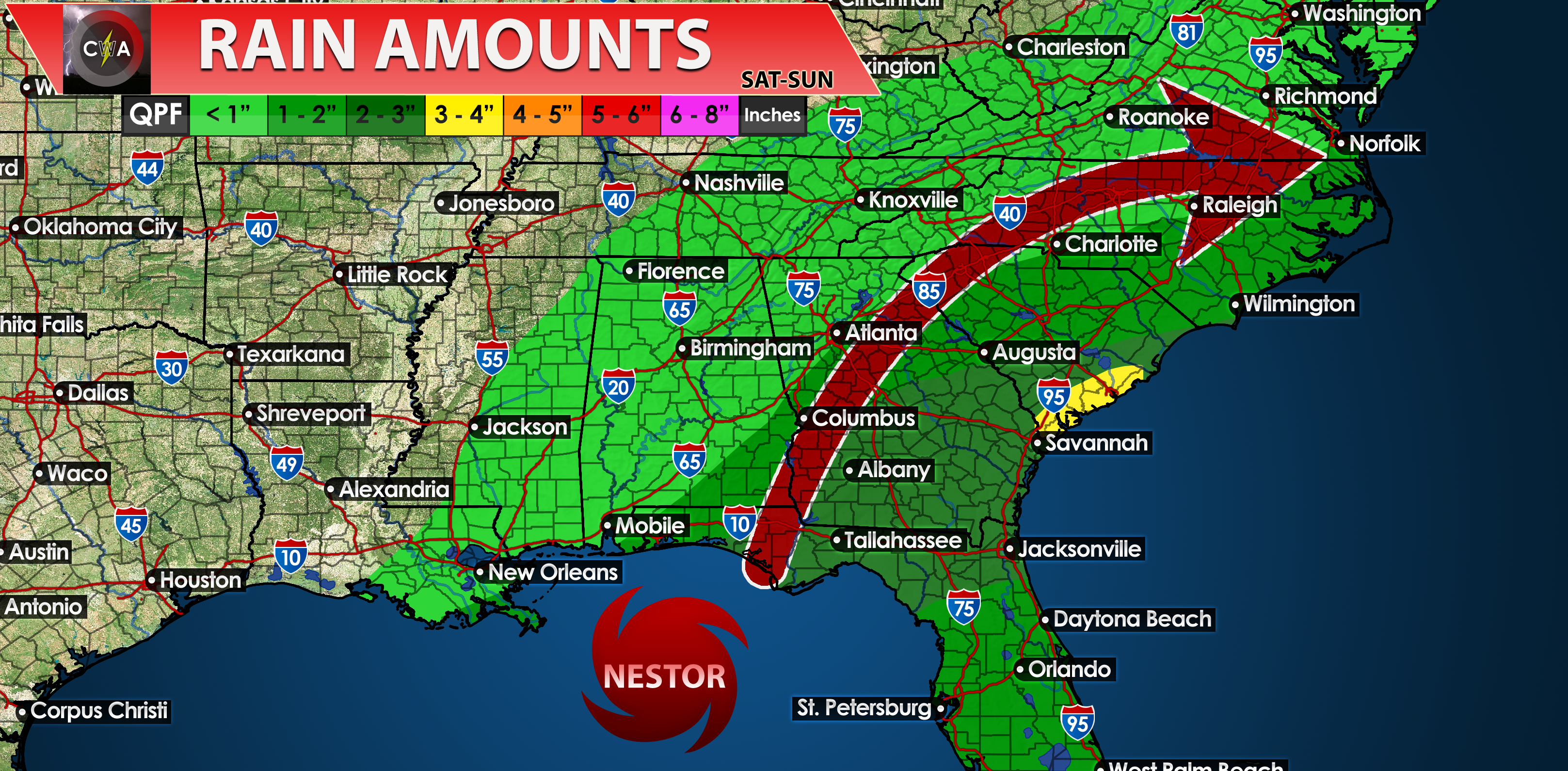
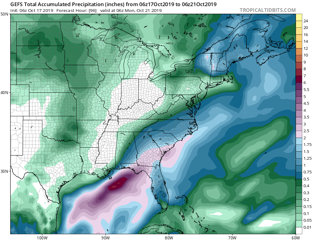
The GEFS ensembles are indicating that the heaviest rains will be over Georgia and South Carolina. This is good news for them, however the catch is that it will be windy, and widespread power outages are possible. In fact, these power outages are possible anywhere in the Carolinas and southeast Virginia as well. This will be a broad system, with impacts extending inland, although not extreme.
Stay tuned on the latest developments with potential future Nestor.
CWA
You must be logged in to post a comment.