
The pattern that we are currently in has been very quiet, especially along the East Coast. We have been encountering above average temperatures and a zonal flow which hasn’t brung us any major winter storms. That will be changing however as we head into next week as a Miller B type nor’easter looks to affect the East Coast. Here is a look on who potentially will be effected and see the heaviest snow:
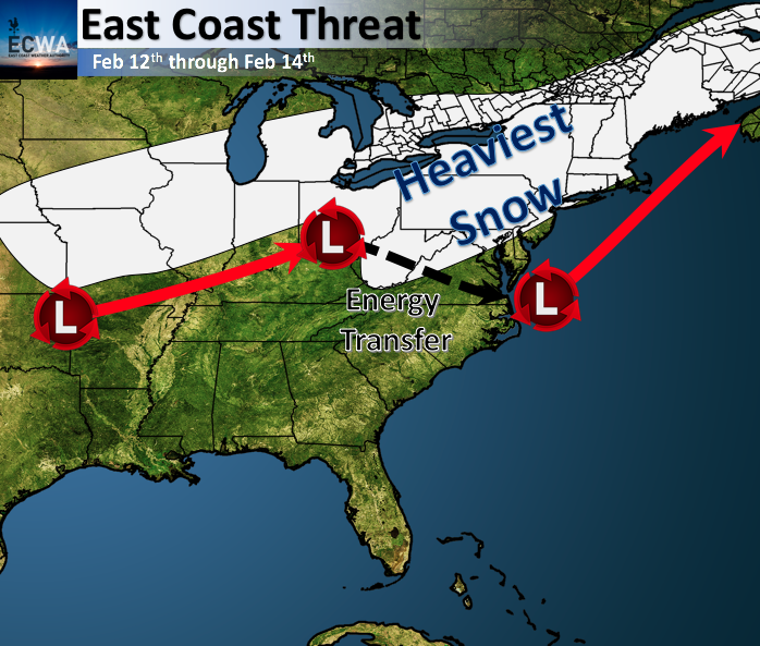
Although the pattern has been quiet along the East Coast, things will be changing to a more favorable pattern next week. Models have been consistent with the threat of snow stretching from the Midwest to Ohio Valley and into the Mid-Atlantic/Northeast over the past couple of days.
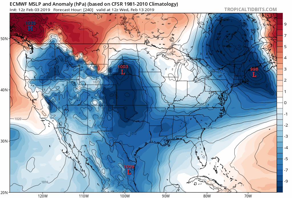
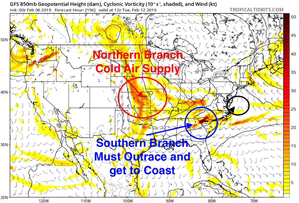
A major component for this upcoming system will be if the southern branch of energy out races the northern branch to the East Coast.
Models will continue to switch back and forth, fighting each other for the end result until Saturday when our main pieces make landfall on the West Coast of the US.
Continue to follow along with us as we keep you up to date on our potential heavy snow maker.
-Alex B.
You must be logged in to post a comment.