
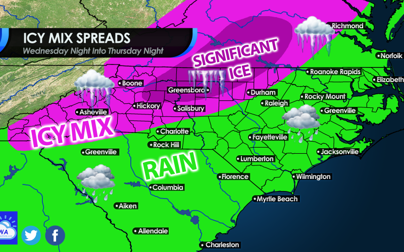
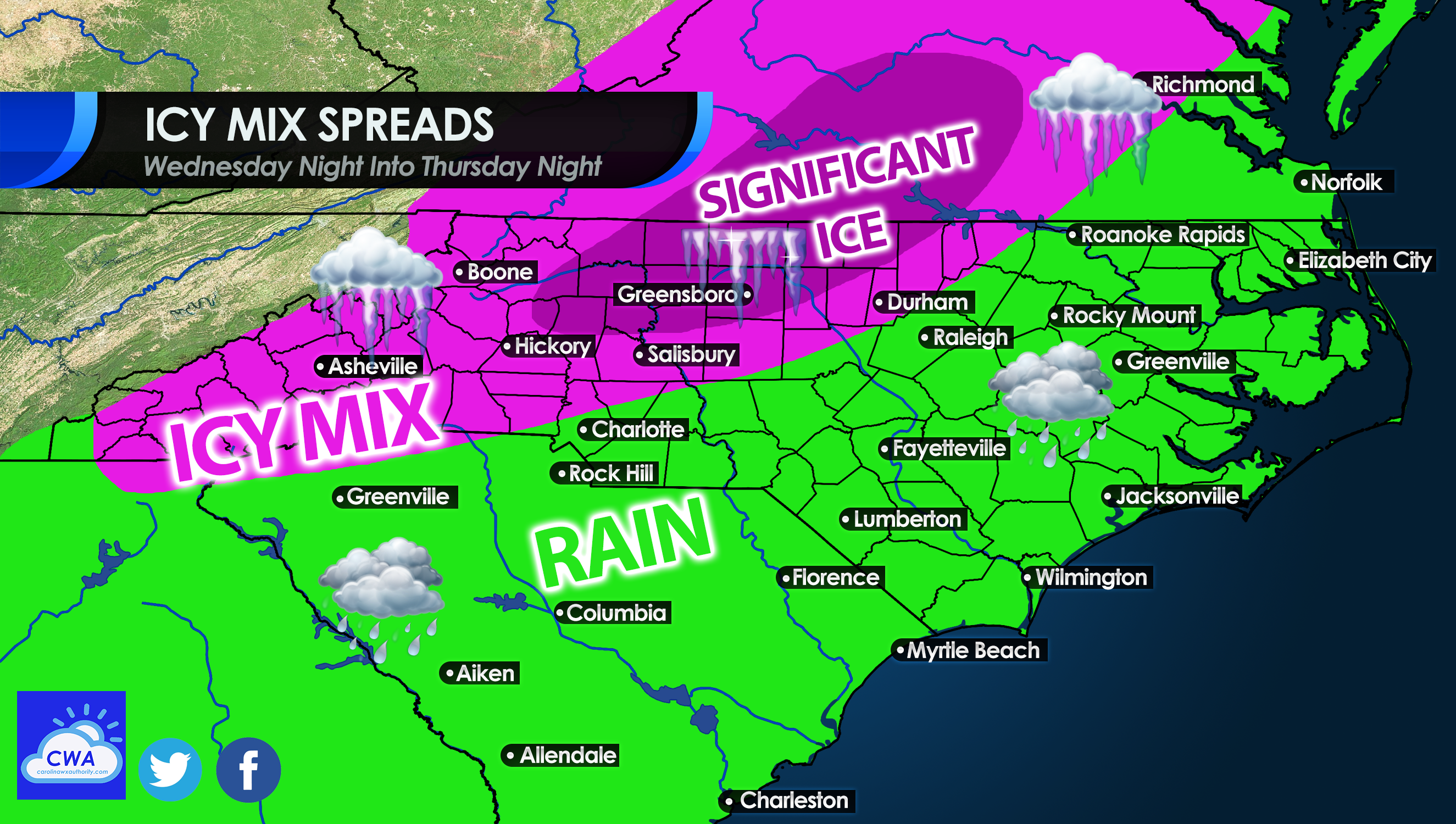
Early on Thursday morning is when icy conditions will overspread North Carolina, and a part of the South Carolina Upstate. Travel will become dangerous on Thursday as conditions worsen, especially for western NC. One hard-hit area could be Greensboro and north into Virginia, as up to an inch of ice is possible in this area. For some, a recent ice storm combined with more ice could prove to be disastrous, especially with impassible roads and extended power outages. For anyone in the green, a cold rain is expected, so some hot chocolate or chili could be in order.
TIMING:
As Thursday morning approaches, sleet and freezing rain will spread across western regions between 1 and 7 am. An icy glaze is possible by sunrise for North Charlotte and anyone in the pink below. Raleigh and the surrounding areas could see a glaze by sunrise also.
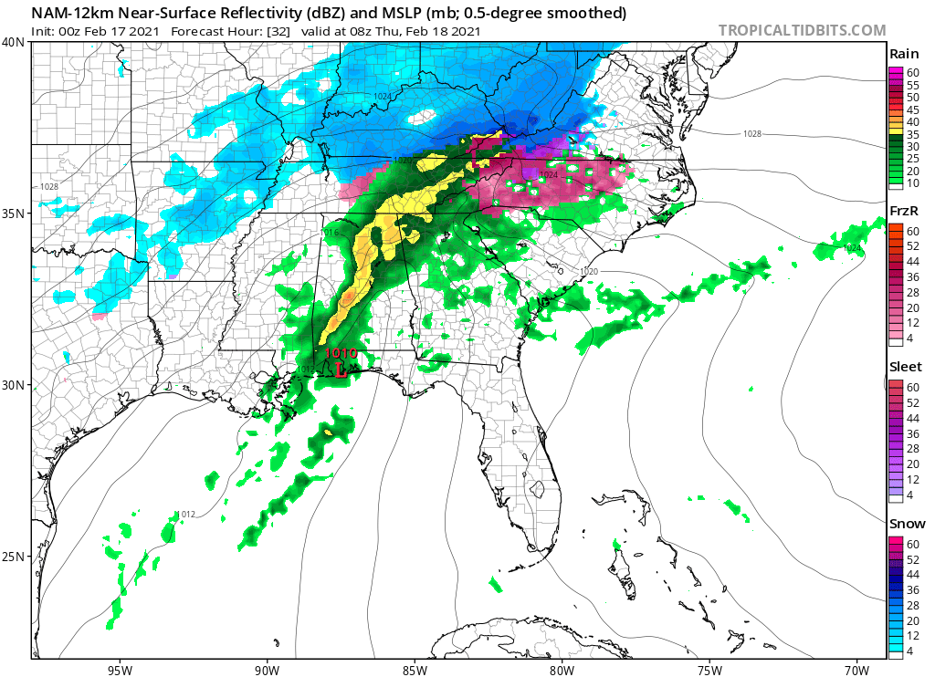
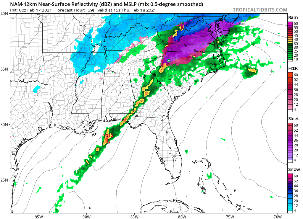
There is no changeover to all rain expected for many across western NC and VA, thus prolonging the period of icing. The same overall precip type pattern is expected into Thursday afternoon (below). This is not looking good for western and northern NC as well as central and southern VA. Make preparations now if possible before conditions no longer allow you to do so.
In some areas, power could be out for up to 2 weeks. Make plans and preparations now to survive without electricity for an extended period of time. Also, don’t go near downed power lines, as they still may be live.
This is an extremely dangerous situation developing, and should be taken seriously. Heed all recommendations and action items from your local NWS office.
You must be logged in to post a comment.